
Intervals of fl oodplain formation along the Little Missouri River, North Unit of Theodore Roosevelt National Park, North Dakota, as of 2003
By Fort Collins Science Center
2009 (approx.)

Detailed Description
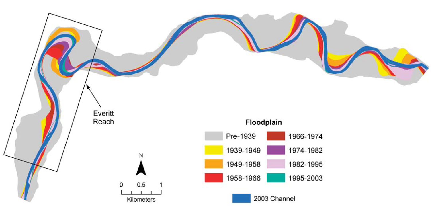
Intervals of floodplain formation along the Little Missouri River, North Unit of Theodore Roosevelt National Park, North Dakota, as of 2003. The map was generated using the image-comparison method, overlaying images from 1939, 1949, 1958, 1966, 1974, 1982, 1995, and 2003. Dates define the photo interval during which the status of a polygon last changed from channel to floodplain. The rectangle indicates the location of the reach mapped by another scientist in 1968. The outer edge of the floodplain is bounded by alluvial fans, hillslopes, and sporadic bedrock outcrops. Figure from Miller and Friedman (2009).
Sources/Usage
Public Domain.
Related

Reconstructing Flow History From Riparian Tree Rings
FORT aquatic scientists analyze rings of riparian trees relating tree growth and establishment to historical flow. They then use the tree rings to reconstruct the flow in past centuries. Flow reconstructions discover the frequency and magnitude of past droughts and floods—information that is essential for management of rivers and water supplies. They have pioneered the use of cottonwood, a...
Related
Reconstructing Flow History From Riparian Tree Rings
FORT aquatic scientists analyze rings of riparian trees relating tree growth and establishment to historical flow. They then use the tree rings to reconstruct the flow in past centuries. Flow reconstructions discover the frequency and magnitude of past droughts and floods—information that is essential for management of rivers and water supplies. They have pioneered the use of cottonwood, a...