
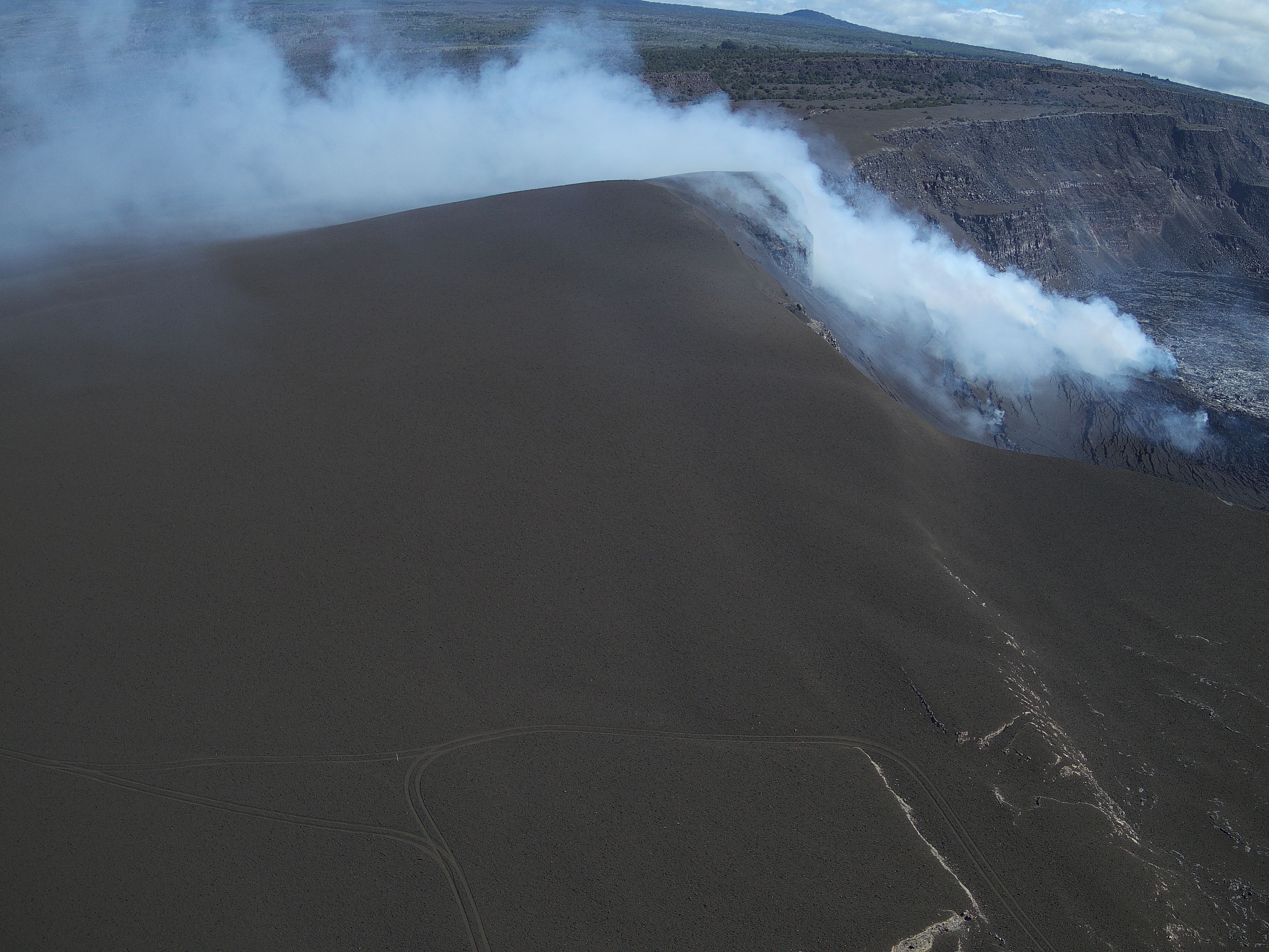
July 25, 2025 — UAS view of tephra cone

Detailed Description
This oblique aerial view of the tephra cone from the ongoing Kīlauea summit eruption was captured during a USGS Hawaiian Volcano Observatory UAS (uncrewed aircraft systems) flight on July 25, 2025. The aircraft was flying about 120 m (400 ft) above ground level, with the image captured looking to the northeast. The featureless expanse spanning most of the image frame consists of tephra ejected from the eruptive vents (right background, within Halema‘uma‘u crater), with tire tracks in the foreground marking routes that scientists have been using to access monitoring equipment in the area. These UAS flights were conducted with the permission of Hawai‘i Volcanoes National Park, owing to the Hawaiian Volcano Observatory's mission to monitor active volcanoes in Hawaii, assess their hazards, issue warnings, and advance scientific understanding to reduce the impacts of eruptions. Unauthorized launching, landing, or operating of a UAS from or on lands and waters administered by the National Park Service is prohibited under 36 CFR Closures & Public Use. USGS photo by A. Kekahuna and M. Zoeller.
Sources/Usage
Public Domain.