
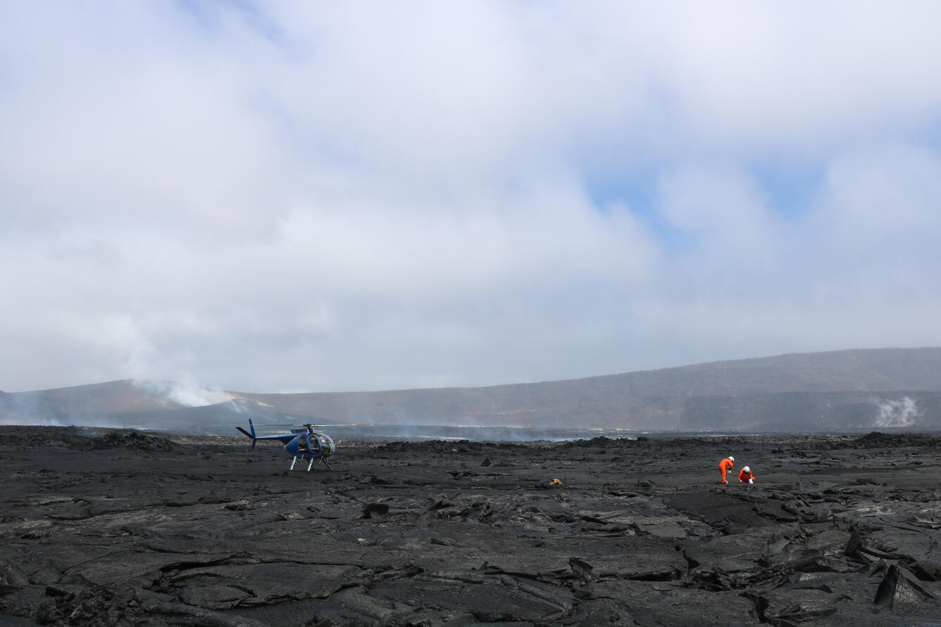
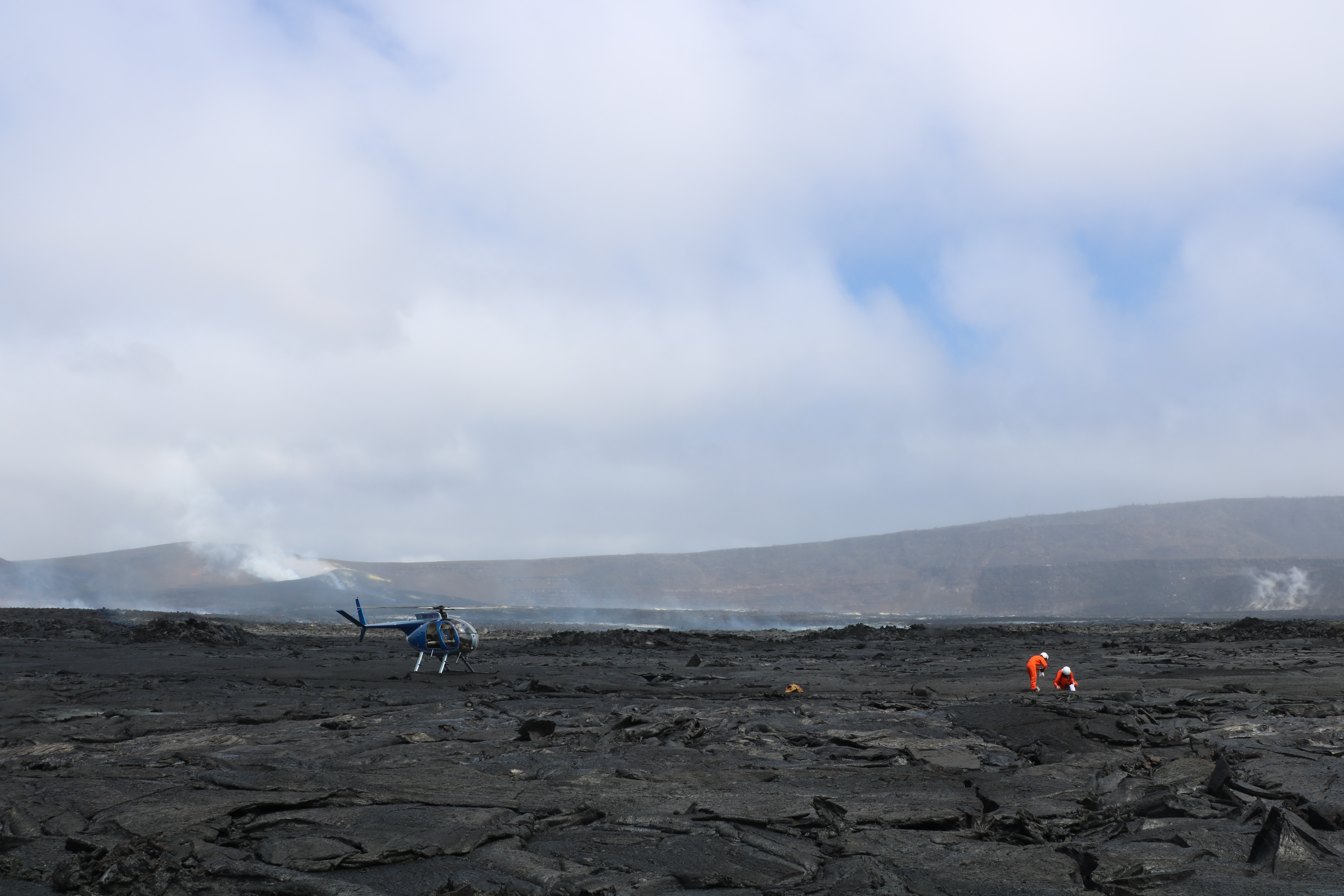
June 24, 2026 — USGS scientists sample in Halemaʻumaʻu, Kīlauea summit
Detailed Description
This photograph, which was taken from the ground in the southeastern portion of Halemaʻumaʻu at the summit of Kīlauea, shows USGS Hawaiian Volcano Observatory scientists collecting samples of a lava flow from episode 49 that took place on June 14, 2026. On the left side of the photo in the background, the vent and cone complex on the west rim of Halemaʻumaʻu is visible, with the vents degassing. On the right side of the photo in the background, the sloping crater rim rises to the summit, or highest point, on Kīlauea: Uēkahuna bluff. This photograph shows the difference in elevation between these two points well. All landing and sampling in Halemaʻumaʻu, with is culturally significant being the home of Pele, is done with permission from Hawaiʻi Volcanoes National Park. Analyses of samples will aid in eruption monitoring and hazard assessment, providing information on magma temperature and storage depths. USGS photo by K. Mulliken.
Sources/Usage
Public Domain.