
Kīlauea Volcano — Halema‘uma‘u Crater Slumping Animation
Detailed Description
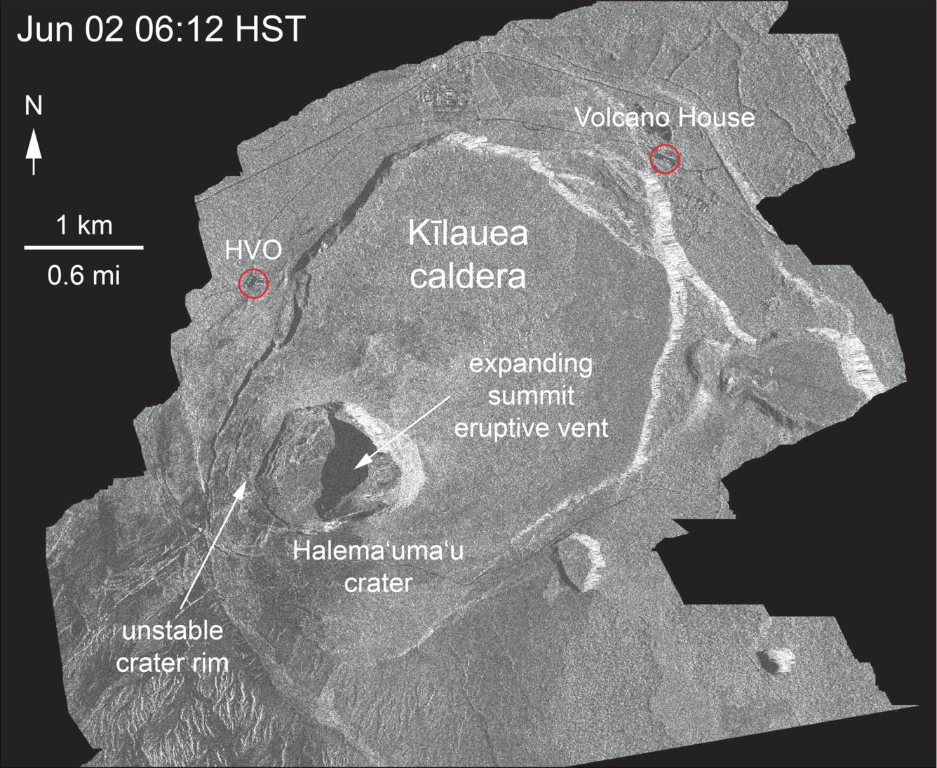
This animated GIF shows a sequence of radar amplitude images that were acquired by the Italian Space Agency's Cosmo-SkyMed satellite system. The images illustrate changes to the caldera area of Kīlauea Volcano that occurred between May 5 and June 2 at 6:00 p.m. HST. The satellite transmits a radar signal at the surface and measures the strength of the return, with bright areas indicating a strong return and dark areas a weak return. Strong returns indicate rough surfaces or slopes that point back at the radar, while weak returns come from smooth surfaces or slopes angled away from the radar. Over time, expansion of the summit eruptive vent within Halema‘uma‘u crater and the widening of Halema‘uma‘u itself are clear. The last image in the sequence, from June 2, shows the development of several cracks outside Halema‘uma‘u (previously seen in UAS footage of the crater) and inward slumping of a large portion of the western crater rim. The west side of Halema‘uma‘u is clearly unstable, and it is possible that rockfalls and continued slumping will occur in the future.
Sources/Usage
Public Domain.