
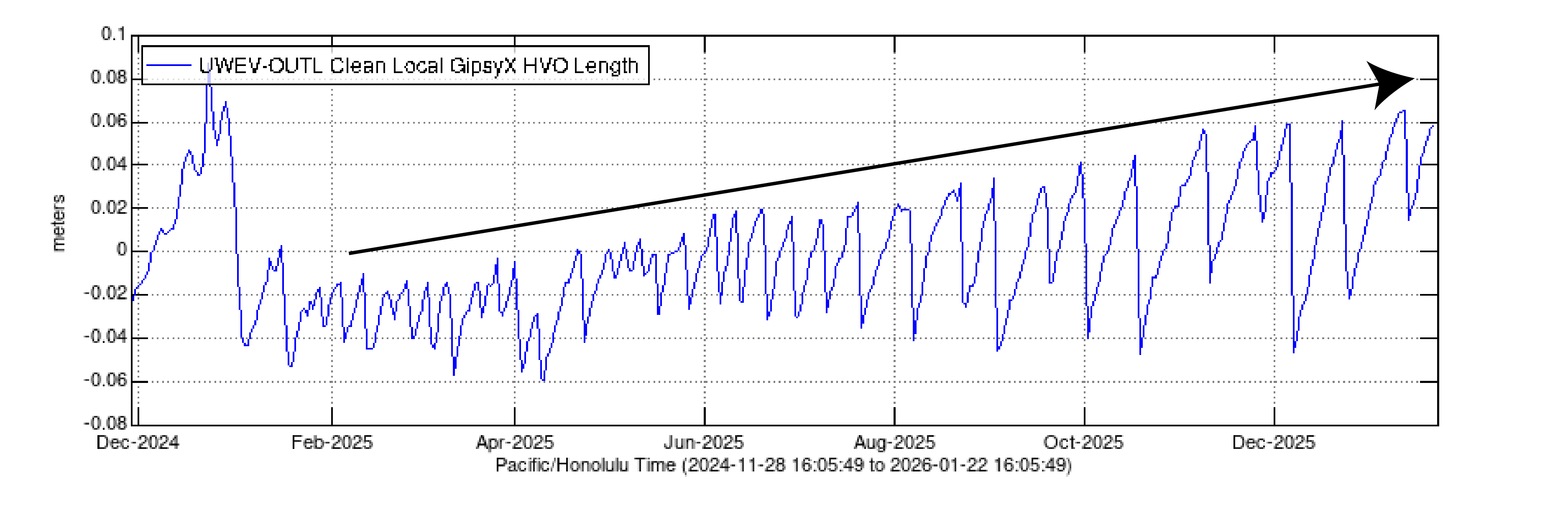
Kīlauea cross-caldera distance determined by GPS stations
Detailed Description
This plot shows the line length between two GPS stations in Kīlauea summit region (UWEV and OUTL) since the episodic summit eruption began on December 23, 2024. These stations are located on opposite sides of the caldera and the distance between them can be used as a proxy for pressurization within the shallow Halemaʻumaʻu magma chamber. The saw-tooth pattern is associated with eruptive episodes over the past year, with each fountaining episode beginning at a peak and ending at a trough. Overall, more pressurization is required to start each fountaining episode, as shown by the black arrow.
Sources/Usage
Public Domain.