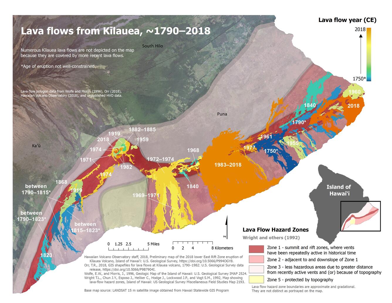
Kīlauea historical activity map
Detailed Description
Map showing the subaerial extents of historical lava flows from Kīlauea. Lava flow hazard zones and districts of the County of Hawai‘i are also depicted.
Sources/Usage
Public Domain.

Official websites use .gov
A .gov website belongs to an official government organization in the United States.
Secure .gov websites use HTTPS
A lock () or https:// means you’ve safely connected to the .gov website. Share sensitive information only on official, secure websites.
Map showing the subaerial extents of historical lava flows from Kīlauea. Lava flow hazard zones and districts of the County of Hawai‘i are also depicted.
Public Domain.