
Large-scale map with thermal overlay showing active flows
Detailed Description
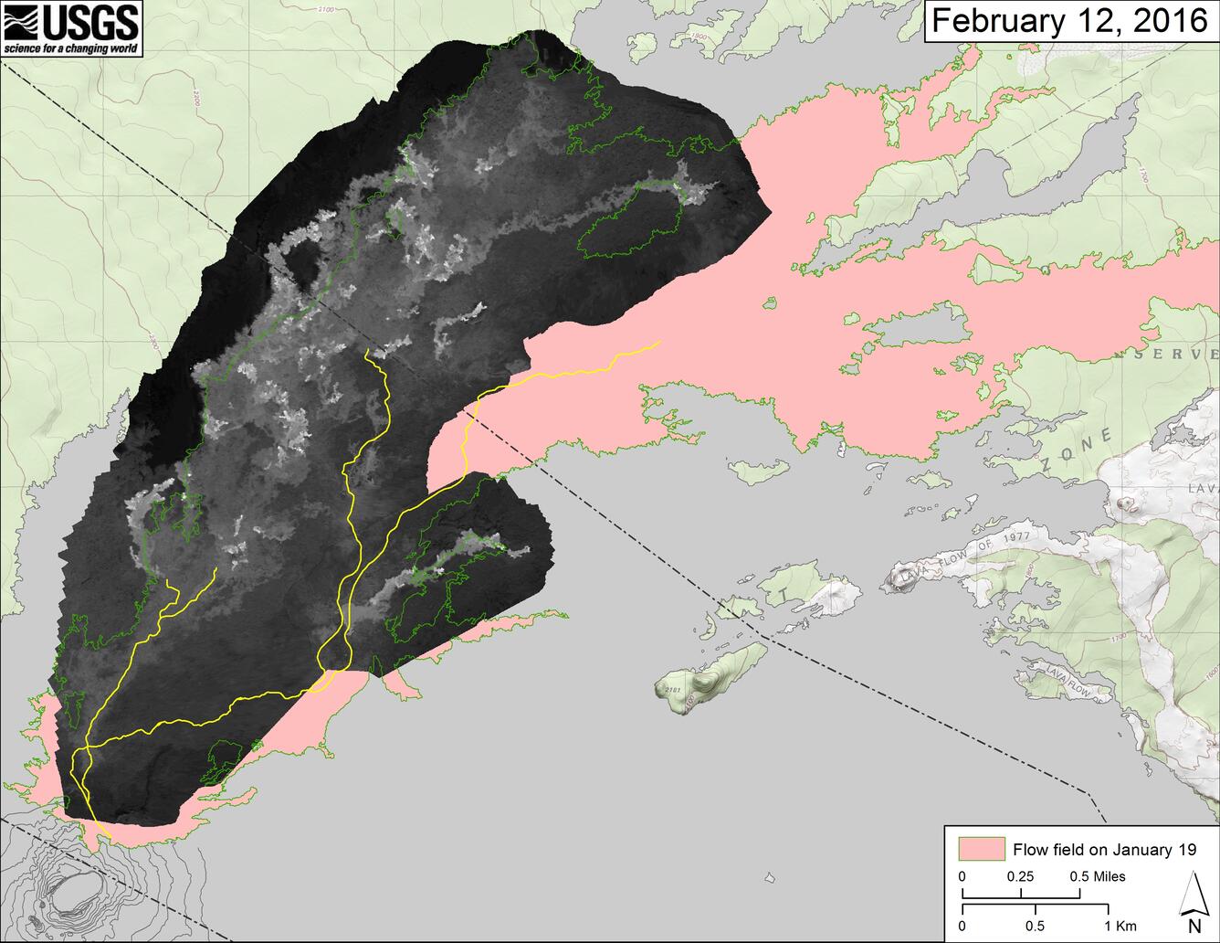
This map overlays a georeferenced thermal image mosaic onto a map of the flow field near Pu‘u ‘Ō‘ō to show the distribution of active and recently active breakouts. The thermal images were collected during a helicopter overflight on February 12. The June 27th flow field as mapped on January 19 is outlined in green for comparison. The yellow lines show the active lava tube system, as currently mapped. Pu‘u ‘Ō‘ō is at lower left.