
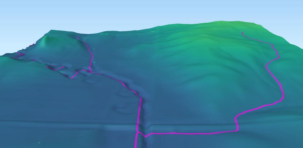
Lidar-derived digital elevation model and NHD stream lines

Detailed Description
The image is a rendering of a lidar-derived digital elevation model of a low relief stream channel and associated National Hydrography Dataset line features in central Iowa. The low topographic relief makes flow accumulation modeling of surface water difficult. The digital models are being used to measure the structure of stream channels in an attempt to identify features that indicate the permanence of channels.
Sources/Usage
Public Domain.
Related

Validation of elevation-derived channels
We are developing methods for autonomous validation of elevation-derived hydrographic features using remote sensing data to update the NHD.
Related
Validation of elevation-derived channels
We are developing methods for autonomous validation of elevation-derived hydrographic features using remote sensing data to update the NHD.