



Lidar map showing erosion and deposition
By Communications and Publishing
2021 (approx.)
Detailed Description
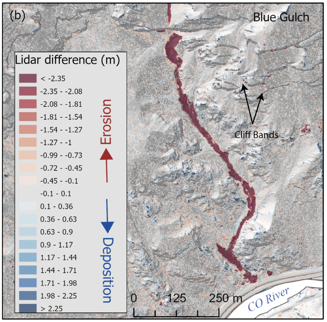
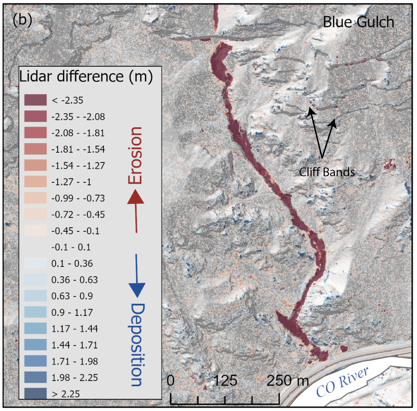
Lidar map showing erosion (red) and deposition (blue) in the lower half of the Devil’s Hole drainage following 2021 debris flows in Glenwood Springs, Colorado.
Sources/Usage
Public Domain.