



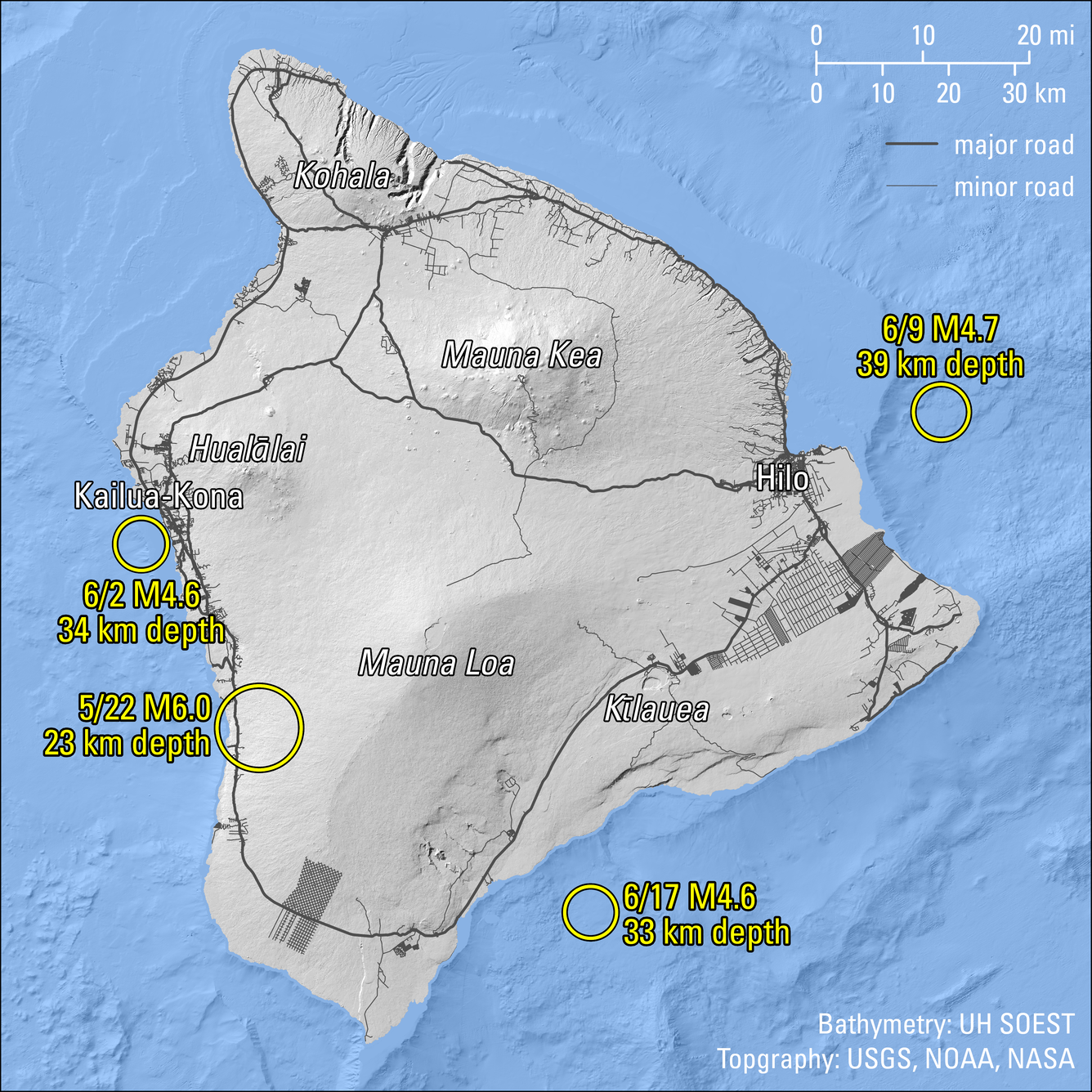
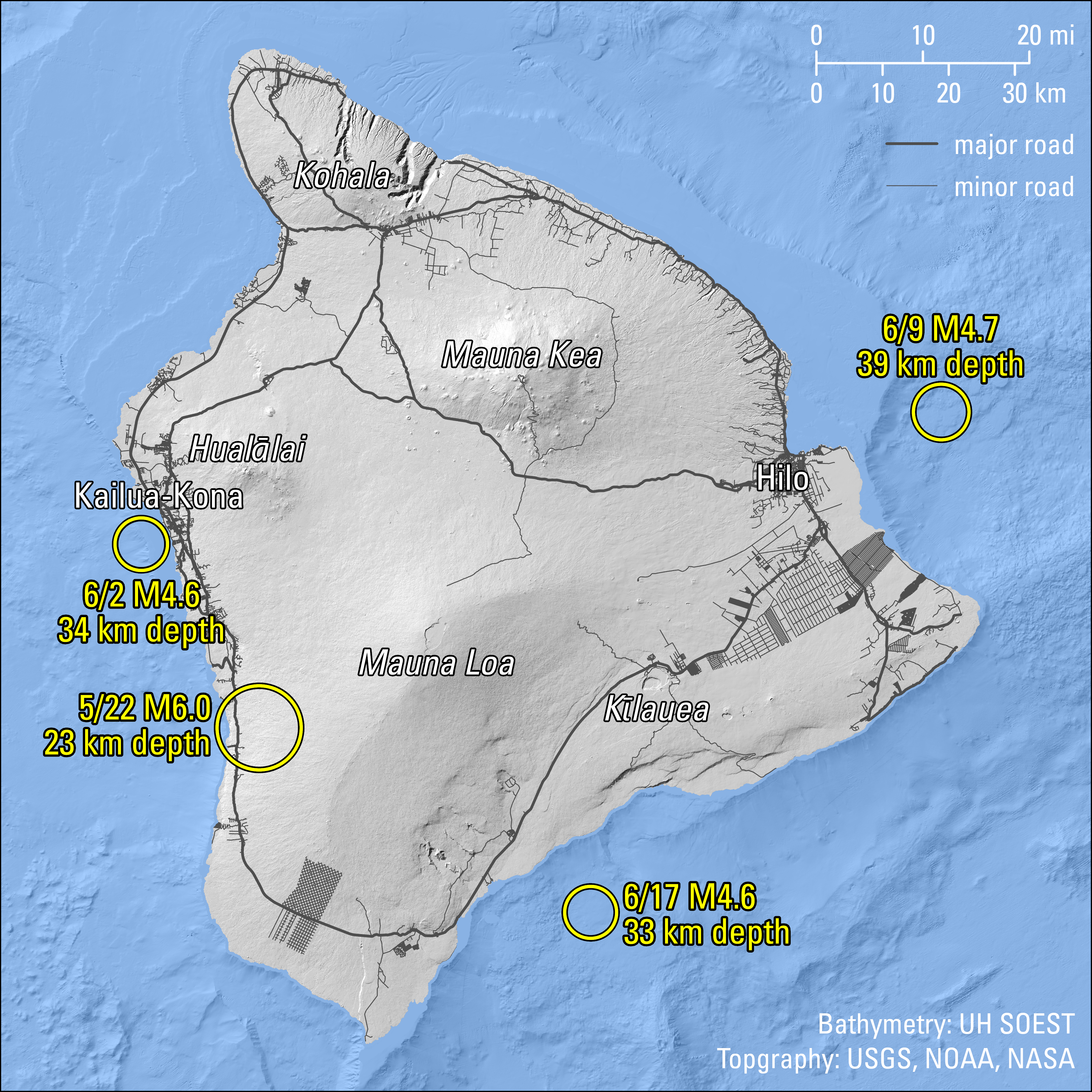
Magnitude 4.5 and greater earthquakes beneath the Island of Hawaiʻi in May and June 2026


Detailed Description
This map figure shows the locations of magnitude-4.5 and greater earthquakes around the Island of Hawaiʻi in May and June 2026. A magnitude-6.0 earthquake on May 22 occurred beneath the west side of the Island of Hawaiʻi, southeast of Captain Cook at a depth of 14 miles (23 km) below the ocean surface. Two others that were unrelated, yet widely felt, followed a few days later: a magnitude-4.6 on June 2, northwest of Keauhou at a depth of 21 miles (24 km); and a magnitude-4.7 on June 9, east of Pepeʻekeo at a depth of 24 miles (39 km). These three earthquakes were caused by the weight of the Hawaiian Island Chain on the brittle oceanic crust and upper mantle below. A magnitude-4.6 south of the Island of Hawaiʻi on June 16 was 11 miles (17 km) deep and not a flexure earthquake, but part of the Pāhala seismic swarm that is thought to be related to hot spot magma transport pathways.
Sources/Usage
Public Domain.