
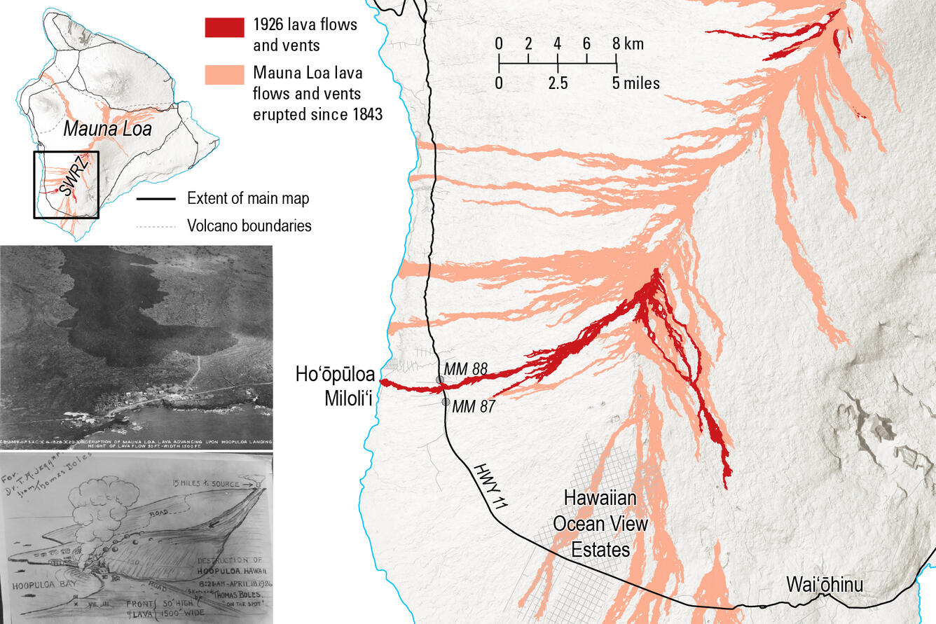
Map of the 1926 Mauna Loa lava flows (red), with all Mauna Loa lava flows since 1843 shown in peach.
Detailed Description
Map of the 1926 Mauna Loa lava flows (red), with all Mauna Loa lava flows since 1843 shown in peach. The eruption started at the summit (top right of main map) on April 10. Magma then migrated down the Southwest Rift Zone (SWRZ), and the eruption resumed with several branches (middle of the main map), the most notable of which destroyed Ho‘ōpūloa village on April 18, 1926. The flow can be seen today along Highway 11 (HWY 11) between mile markers (MM) 87 and 88. The photo on the left was taken on April 17 by the U.S. Army Air Corps,11th Photo Section, and shows that the flow advancing towards Ho‘ōpūloa village. The sketch on the bottom left is by Thomas Boles, the first superintendent of Hawaii National Park, drawn as lava was inundating Ho‘ōpūloa village.
Sources/Usage
Public Domain.