
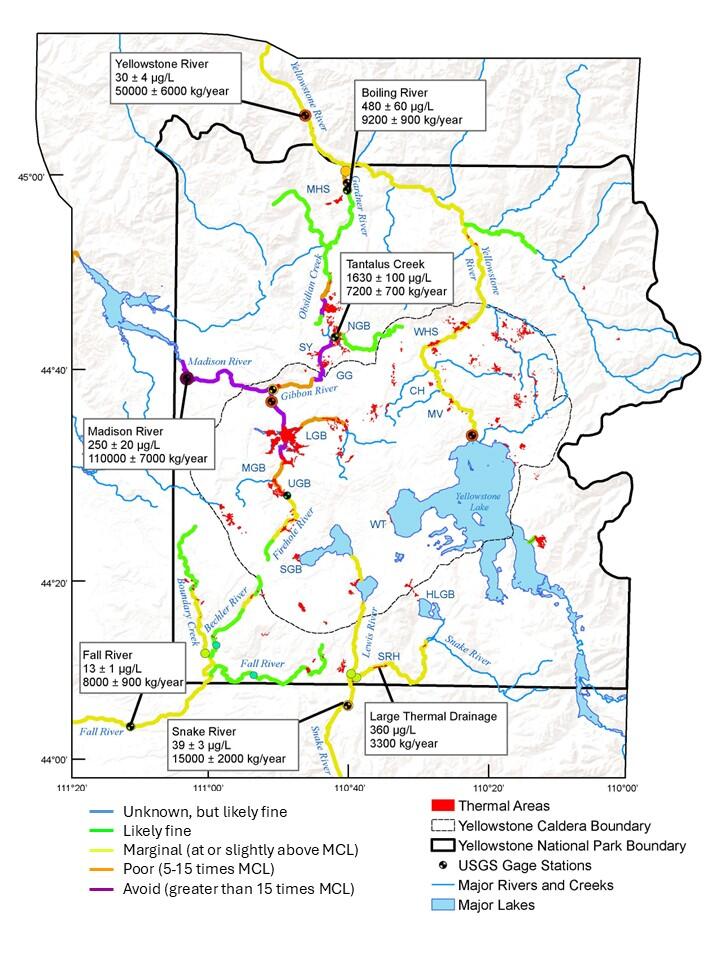
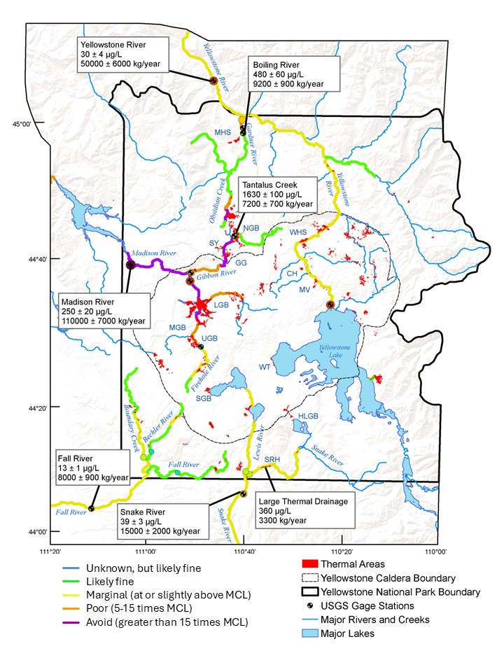
Map of arsenic concentrations in Yellowstone National Park rivers
By Yellowstone Volcano Observatory
2022 (approx.)
Detailed Description
Map of Yellowstone National Park lakes, rivers, and streams, with colors indicating the amount of arsenic in the water. The Maximum Contaminant Level (MCL) defined by the Environmental Protection Agency for arsenic in drinking water is 10 micrograms per liter (µg/L). In the vicinity of major geyser basins, especially on the Firehole and Madison Rivers, arsenic levels far exceed the MCL (orange and purple areas on map). Map is based a figure in McCleskey and others, 2022 (https://doi.org/10.1016/j.jvolgeores.2022.107709).
Sources/Usage
Public Domain.