
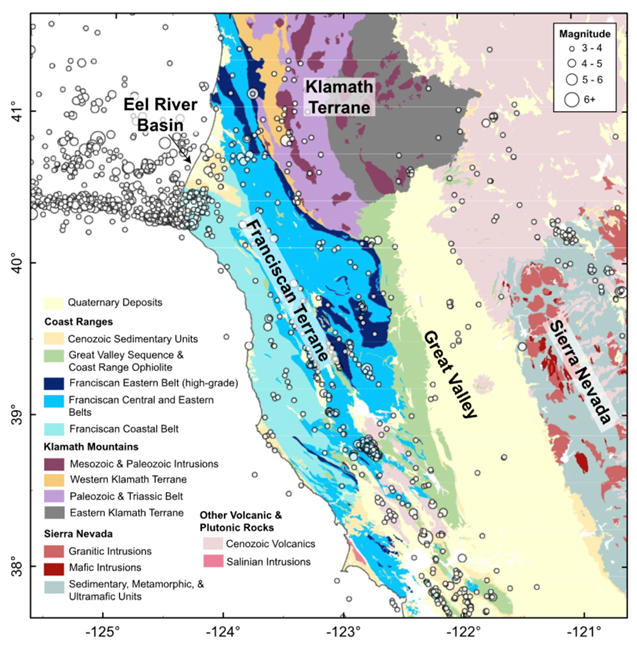
Map of location and magnitude of seismic events and rock types of the west coast of California and southern Oregon
Detailed Description
This map, taken from a 2024 journal article by Furlong et al. 2024, shows the location and magnitude of seismic events (earthquakes) and rock type on a basemap of a portion of the west coast of North America. A striking concentration of seismic activity can be seen offshore, just south of the labeled “Eel River Basin.” This seismicity is the product of earthquakes associated with movement along the tectonically complex Mendocino Triple Junction, where the Pacific, Juan De Fuca, and North American tectonic plates meet.
Sources/Usage
Public Domain.
Furlong, K. P., Villaseñor, A., Benz, H. M. & McKenzie, K. A. 2024. Formation and Evolution of the Pacific-North American (San Andreas) Plate Boundary: Constraints From the Crustal Architecture of Northern California. Tectonics 43, https://doi.org/10.1029/2023TC007963