
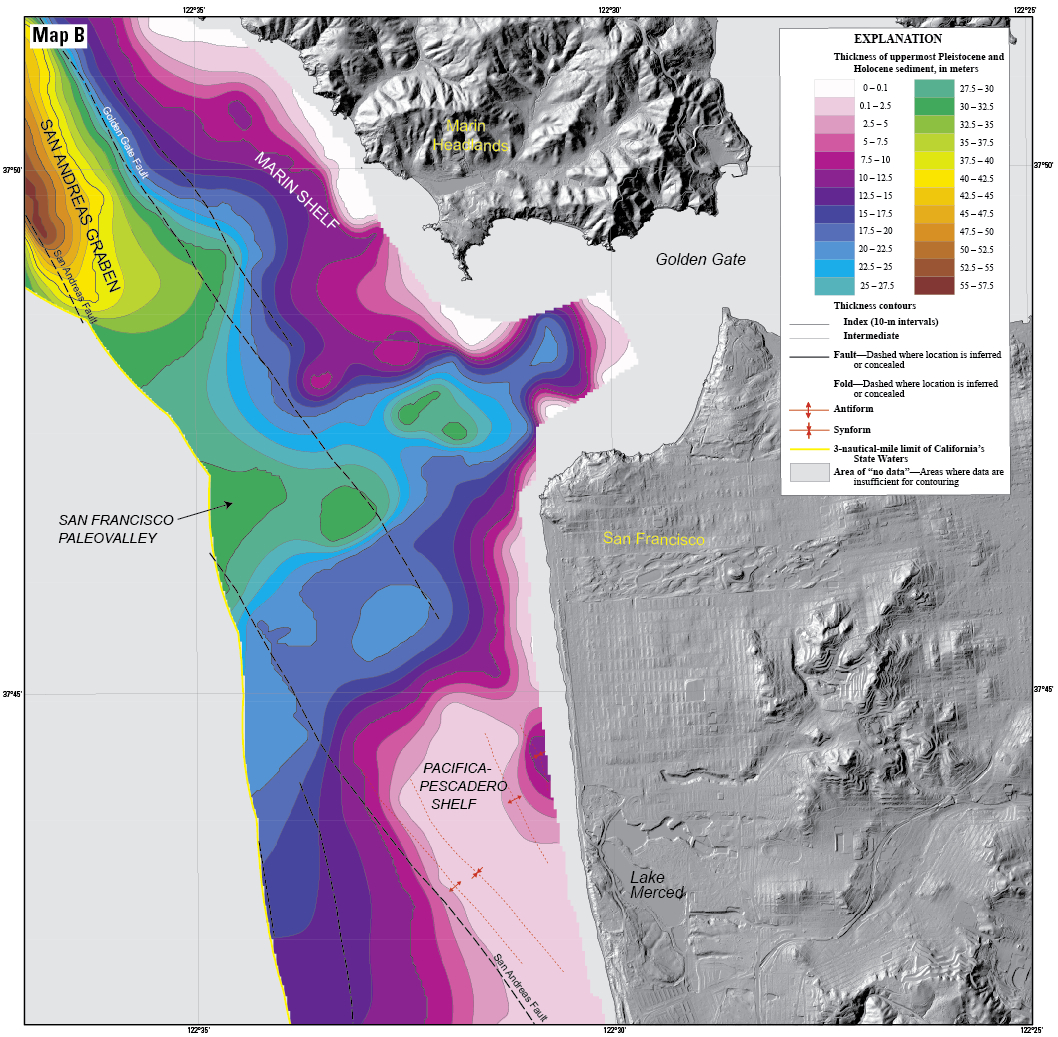
Map of sediment thickness in state waters offshore of San Francisco.

Detailed Description
Map of sediment thickness in state waters offshore of San Francisco. About 21,000 years ago, sea level in this area was about 125 m lower and the shelf offshore San Francisco was an emergent land surface. At that time, the Sacramento River drained through the Golden Gate and eroded a valley ("the San Francisco paleovalley”) that was filled with sediment during subsequent sea-level rise. The thickest young sediment in the region occurs in the “San Andreas graben,” a basin that formed by crustal down dropping along the offshore section of the San Andreas fault. There is very little sediment on the shelf offshore of southern Ocean Beach (a pattern that extends south to Pescadero), a factor important for understanding and forecasting coastal erosion in this area.