
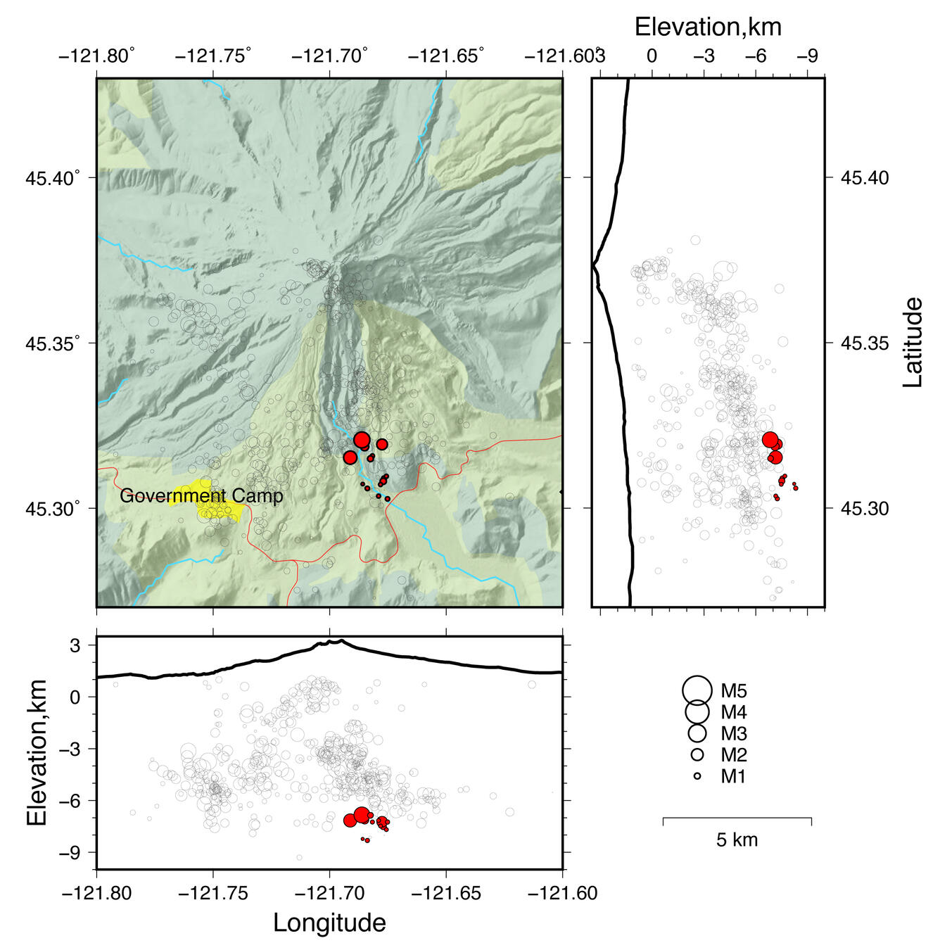
Map view of well recorded historical seismicity at Mount Hood since...
Detailed Description
Bottom: Cross-sectional view looking north. Right: Cross-sectional view looking west. Black outline is elevation profile through the summit of Mount Hood. Circles are sized with respect to earthquake magnitude. Earthquake locations from the Pacific Northwest Seismic Network.