
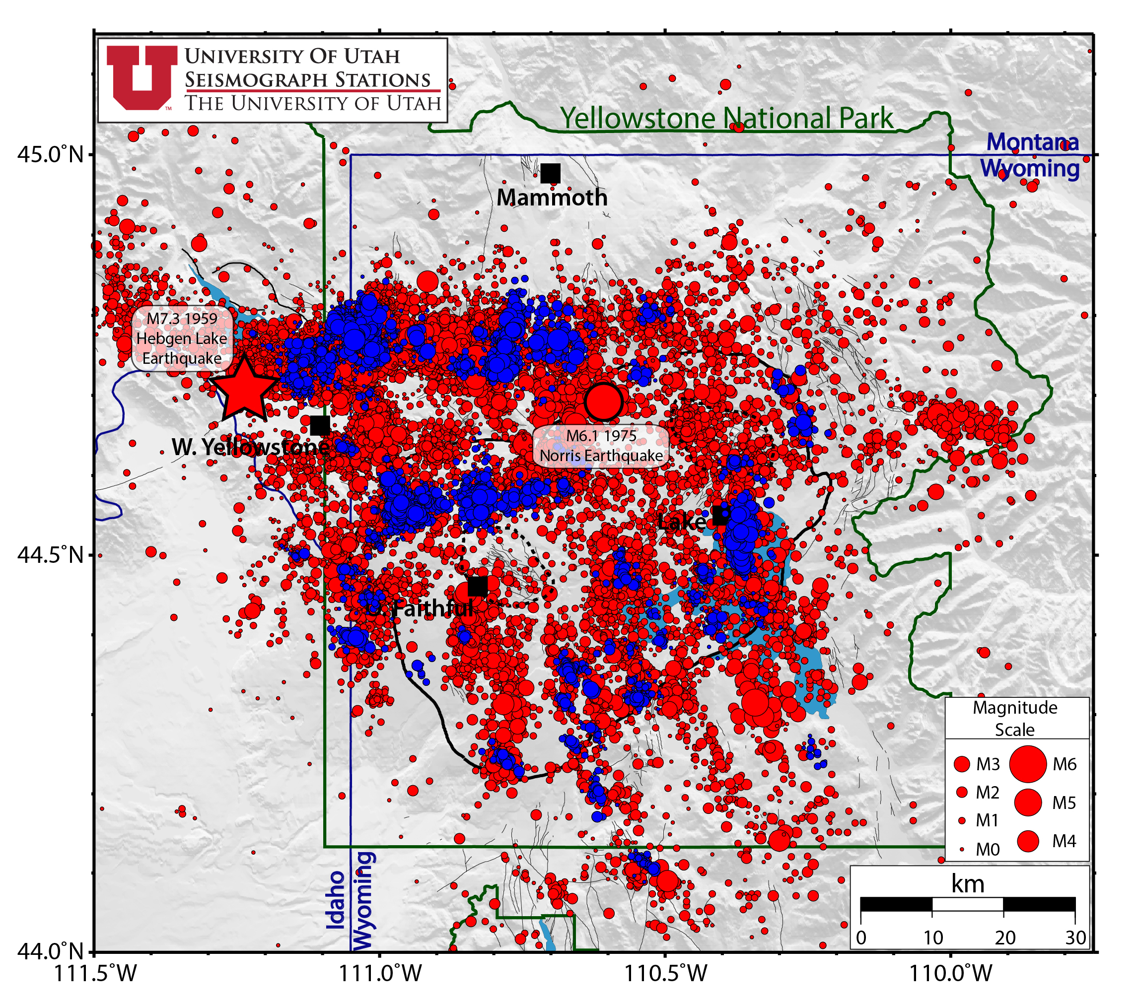
Map of Yellowstone earthquakes as located by the Univ. of Utah Seis...

Detailed Description
Red circles represent all seismicity and blue circles represent earthquakes as part of earthquake swarms. The size of the circles is scaled to the magnitude of the earthquake. The 630,000 year old Yellowstone caldera is shown as a bold black line within Yellowstone National Park. Mapped faults are shown as light gray lines.
Sources/Usage
Public Domain.
Related

Monitoring Earthquakes in Yellowstone National Park
The Yellowstone region is one of the most seismically active areas in the United States. It experiences an average of around 1,500 to 2,500 located earthquakes per year! The majority of these earthquakes are too small to be felt by humans but are detected by a sophisticated network of about 50 seismometers called the Yellowstone Seismic Network (YSN).
Related
Monitoring Earthquakes in Yellowstone National Park
The Yellowstone region is one of the most seismically active areas in the United States. It experiences an average of around 1,500 to 2,500 located earthquakes per year! The majority of these earthquakes are too small to be felt by humans but are detected by a sophisticated network of about 50 seismometers called the Yellowstone Seismic Network (YSN).