
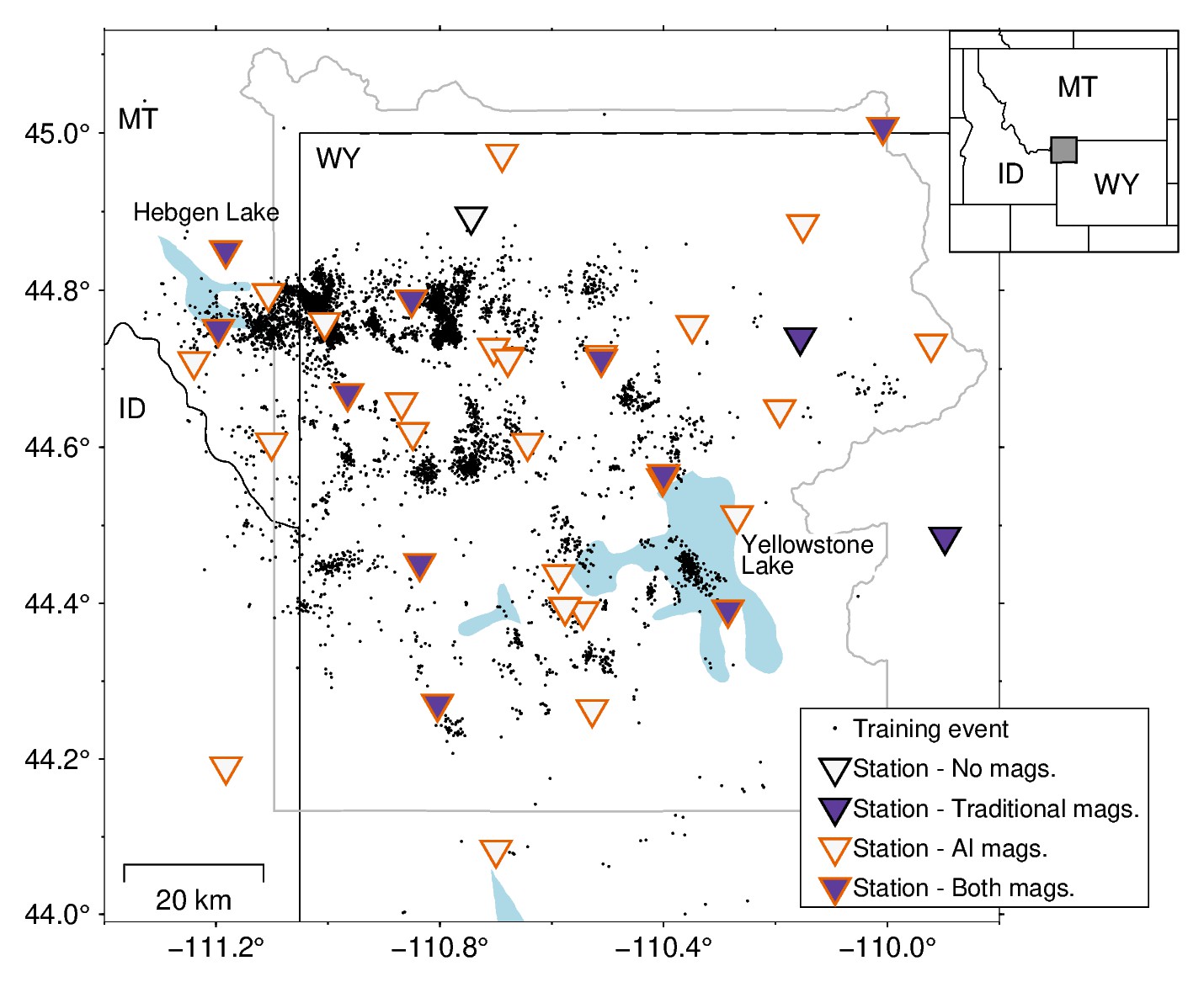
Map of Yellowstone Seismic Network showing stations used to calculate earthquake magnitudes using various methods
By Yellowstone Volcano Observatory
July 2025 (approx.)

Detailed Description
A map of the stations operating in the Yellowstone region between 2012 and 2024 shown as triangles with fill and edge colors indicating whether they are used to calculate magnitudes using traditional approaches, artificial intelligence methods, or both. Many more stations can be used with the AI magnitude method, allowing for more small-magnitude values to be computed. The black dots show the locations of the earthquakes cataloged by the University of Utah Seismograph Stations that were used to train the AI models.
Sources/Usage
Public Domain.