
Map of Yellowstone showing the extent of Lava Creek Tuff and geologic map of Madison Junction area
By Yellowstone Volcano Observatory
2001 (approx.)
Detailed Description
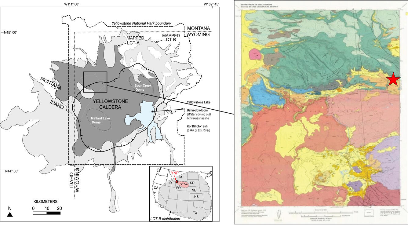
Left: Map of Yellowstone showing the extent of mapped Lava Creek Tuff members A and B, which erupted during the formation of Yellowstone Caldera about 631,000 years ago. Right: Geologic map of Madison Junction (1:125,000). Red star represents the location of a layer that was initially assigned to the Lava Creek Tuff but that is substantially older and represents a previously unknown eruptive unit. Modified from Christiansen (2001) and Matthews et al. (2015).
Sources/Usage
Public Domain.