
Mapping Application: Overlay Mine and Environmental Data

Detailed Description
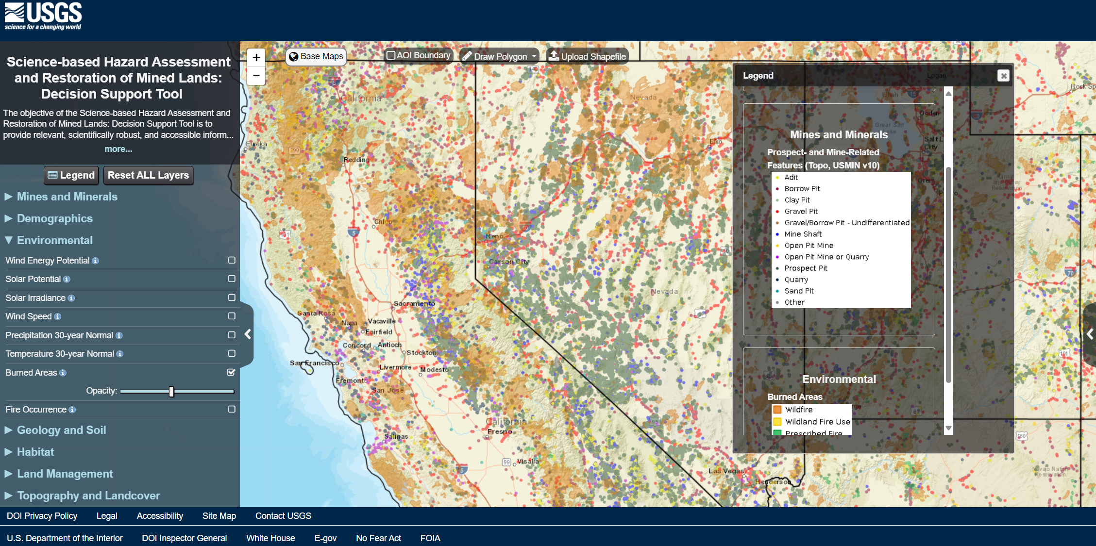
Within the mapping tool, users can overlay mine lands and mine-related features with a variety of other landscape characteristics, such as geology or fire history. This example shows mine features and burn areas, zoomed in on California.
Sources/Usage
Public Domain.