
Mauna Loa Volcano's 1935 lava flow seen in current media coverage of Mauna Kea
Detailed Description
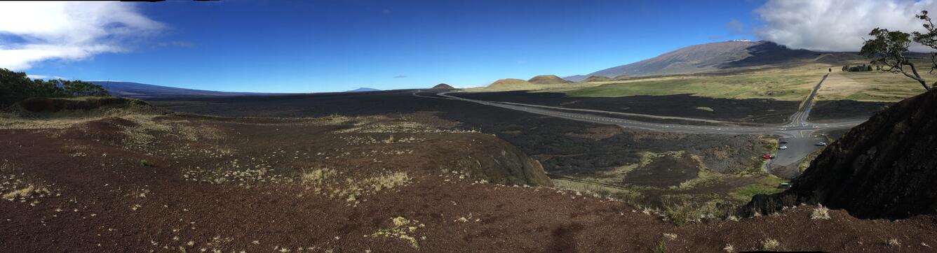
This panoramic view of the 1935 Humu‘ula flow (black lava) on both sides of the Daniel K. Inouye Highway, which runs east to west in the saddle between Mauna Loa (snow-capped shield volcano at far left) and Mauna Kea (distant right), was taken from the top of Pu‘uhuluhulu. View is to the northwest. The top of Hualālai is visible in far distance (center). USGS photo by J. Kauahikaua, 01/01/2017.
Sources/Usage
Public Domain.