
May 7, 2021—Kīlauea summit eruption contour map

Detailed Description
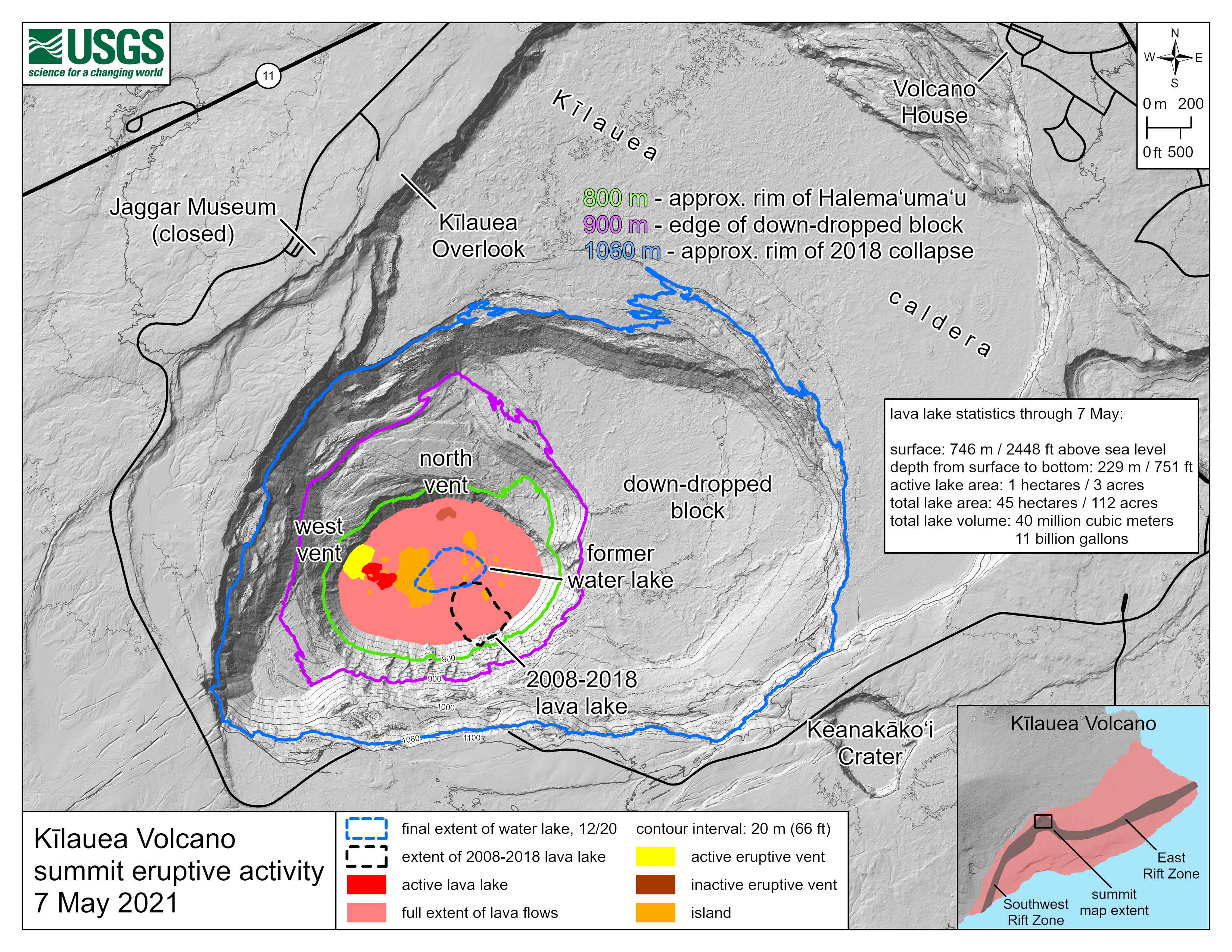
This map of Halema‘uma‘u at the summit of Kīlauea shows 20 m (66 ft) contour lines (dark gray) that mark locations of equal elevation above sea level (asl). The map shows that the lava lake has filled 229 m (751 ft) of the crater, to an elevation of 746 m (2448 ft) asl since the eruption began on December 20, 2020. Contour lines highlighted in green, purple, and blue mark the approximate rim of Halema‘uma‘u, the edge of the eastern down-dropped block, and the approximate rim of the 2018 collapse, respectively. Lava is expected to be within view of the Kīlauea Overlook visitor area shortly before it rises to the level of the green contour line at 800 m (2625 ft) asl. USGS map.
Sources/Usage
Public Domain.