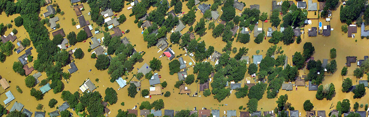
NGS Aerial Imagery of Louisiana Flooding
Detailed Description
Aerial imagery of flooding in Louisiana. Image created by Jason Burton, USGS, using aerial imagery taken by NOAA aviators on behalf of the National Geodetic Survey.

Official websites use .gov
A .gov website belongs to an official government organization in the United States.
Secure .gov websites use HTTPS
A lock () or https:// means you’ve safely connected to the .gov website. Share sensitive information only on official, secure websites.
Aerial imagery of flooding in Louisiana. Image created by Jason Burton, USGS, using aerial imagery taken by NOAA aviators on behalf of the National Geodetic Survey.