
NM Earth MRI Map
By Communications and Publishing
March 2026 (approx.)

Detailed Description
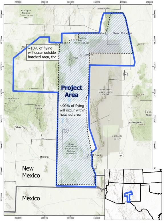
Map showing the location of the survey over New Mexico. The vast majority -- 90 % -- of aircraft flights will occur within the hatched area, while the remaining flights will be located in the northwestern portion of the project area. Flights will cover areas within the New Mexico counties of Doña Ana, Lincoln, Luna, Sierra, Socorro, Torrance, and Valencia.
Sources/Usage
Public Domain.