
Observed and simulated morphologic change via Landsat satellite images
Detailed Description
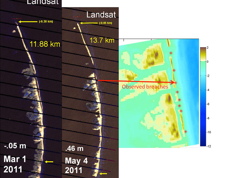
Observed morphologic change via Landsat satellite images on March 1 and May 4, 2010 (left) and (right) simulated breach evolution using sequential model runs (e.g. using final predicted morphology on March 25, 2010 from simulation in previous figure to initialize new model simulation for April 2010 storms). Simulations show breaching or significant narrowing of the berm where breaches are observed in satellite images (red asterisks).
Sources/Usage
Public Domain.