
October 15, 2021—Kīlauea summit eruption thermal map
Detailed Description
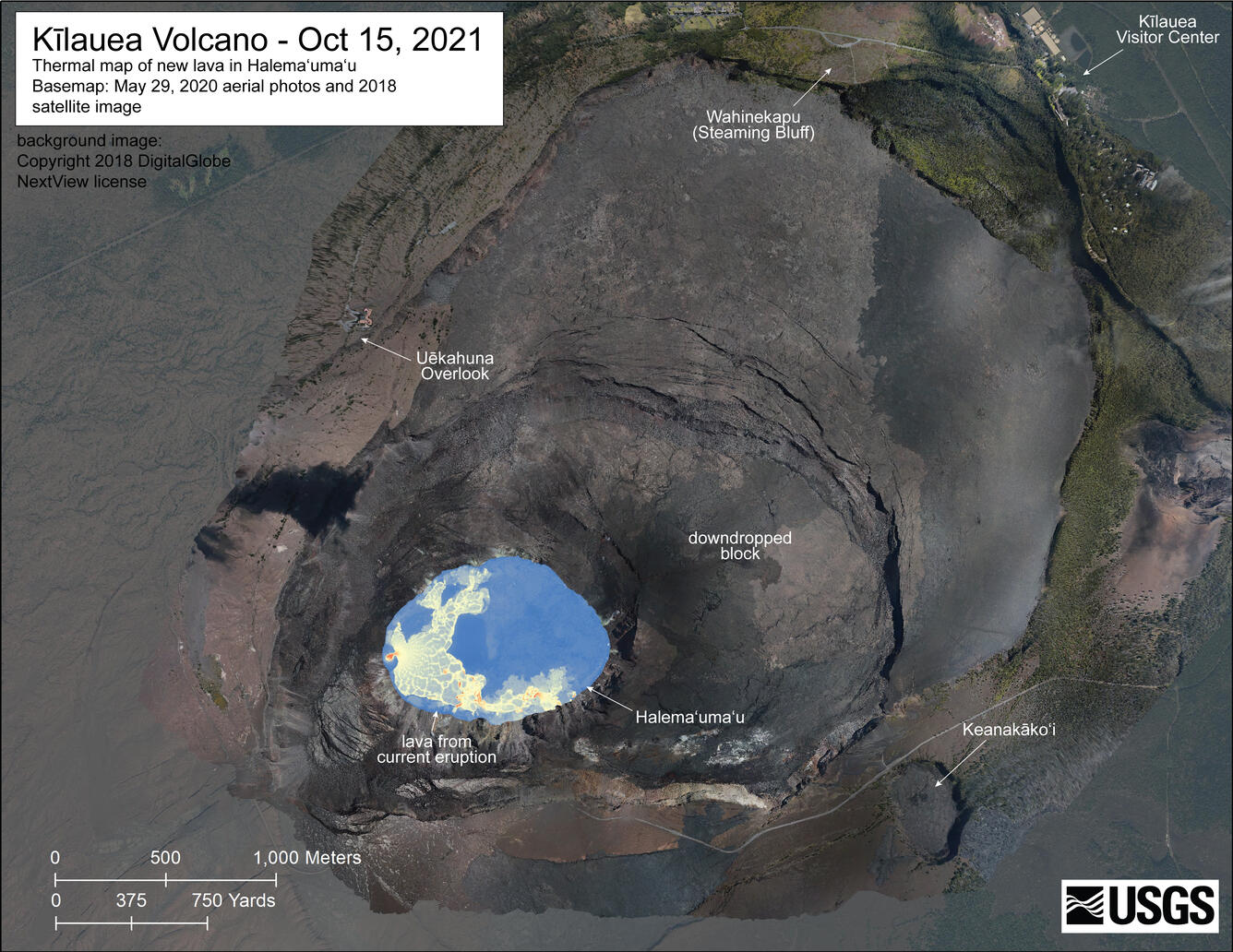
A helicopter overflight on October 15, 2021, at approximately 7:30 a.m. HST allowed for aerial visual and thermal imagery to be collected of Halema‘uma‘u crater at the summit of Kīlauea. The scale of the thermal map ranges from blue to red, with blue colors indicative of cooler temperatures and red colors indicative of warmer temperatures. The dimensions of the new lava lake have not changed drastically since the previous overflight on October 8, 2021—1020 m (0.6 mile) along the east-west axis and 725 m (0.5 mile) along the north-south axis. The estimated area of the lake is about 55 hectares (137 acres). USGS map by M. Patrick.
Sources/Usage
Public Domain.