
Overview map of San Francisco Bay
Detailed Description
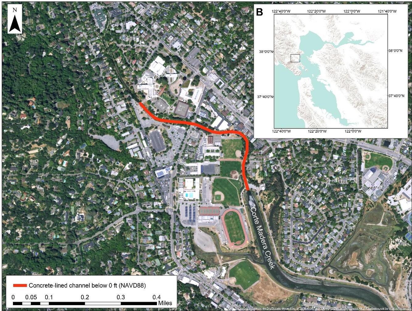
The bold red line in this aerial view of the affected area indicates the concrete-lined channel. The inset image is an overview map of San Francisco Bay, with the location of the Corte Madera Creek watershed indicated by the black outlined rectangle.
Sources/Usage
Public Domain.