
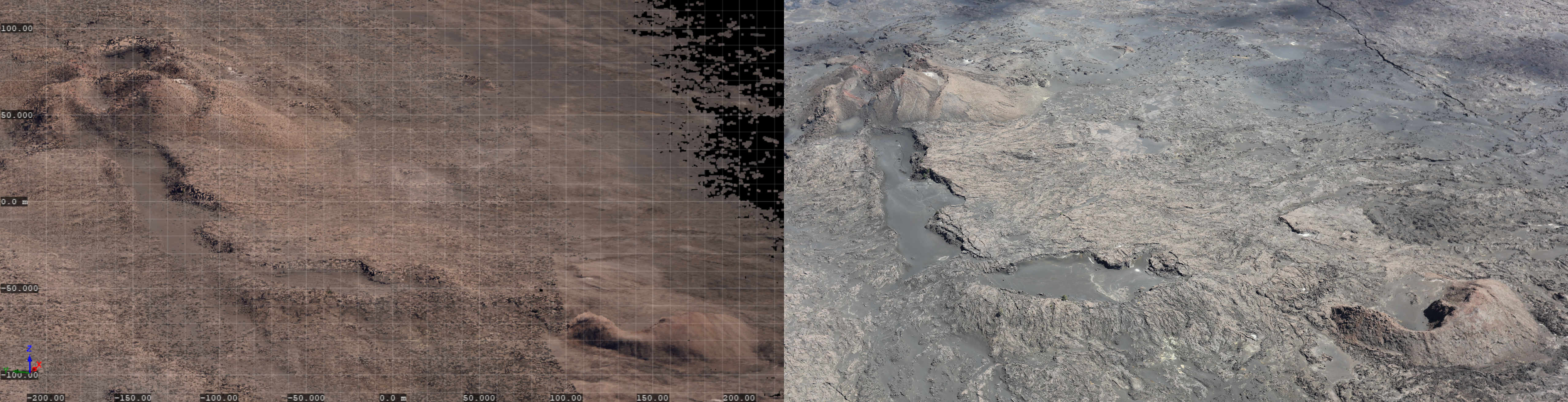
Point cloud and photograph of Pu‘ukoa‘e on Kīlauea
By Hawaiian Volcano Observatory
September 2024 (approx.)
Detailed Description
Left: A snapshot of the point cloud from HVO’s September 5, 2024, lidar test flight along Kīlauea’s Southwest Rift Zone, providing an east-looking oblique view of Pu‘ukoa‘e (upper left) and another unnamed cinder cone (lower right). Points are shown in true color thanks to a camera incorporated with the lidar system, and they taper out to the upper right of the frame, which was the edge of the planned survey area. Tick marks provide an approximate sense of scale, with the width of this view spanning approximately 450 m (1,475 ft). Right: Approximately the same view from a HVO helicopter overflight on February 6, 2024. USGS image by M. Zoeller.
Sources/Usage
Public Domain.