
Point misclassification lidar error
By NGP Standards and Specifications
2021 (approx.)
Detailed Description
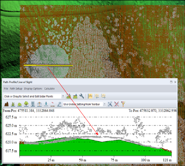
Lidar error dicationary figure 27. Elevation profile showing ground points that have been misclassified as unclassified (gray points). Elevation profile along yellow double line in classified point cloud image.
Sources/Usage
Public Domain.