
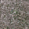
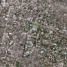
Port-au-Prince After the Earthquake

Detailed Description
High resolution satellite imagery showed the landscape and building damages before and after the magnitude-7 earthquake hit Haiti in the beginning of 2010. This image was taken after the earthquake. These images are part of the USGS Hazard Data Distribution System, which acquires and delivers satellite and aerial imagery in near-real time during natural or human-caused disasters.
Sources/Usage
Public Domain.