
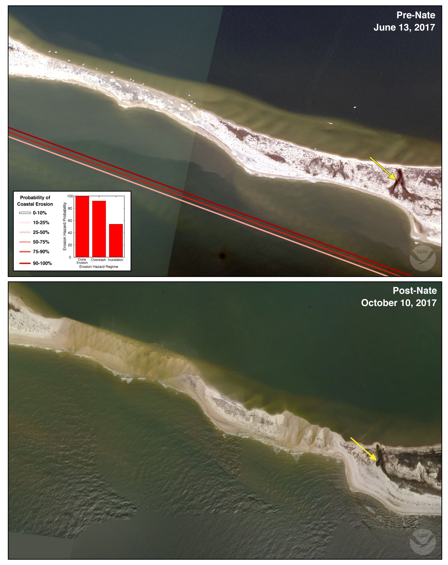
Pre-and Post Storm Photo for Hurricane Nate - Dauphin Island

Detailed Description
The low elevation spit on the far western end of west Dauphin Island was breached during Hurricane Nate. The predicted probability of inundation was 54%, likely due to the inclusion of the higher elevation dunes to the east of the spit in the 1-km alongshore prediction area.
Sources/Usage
Public Domain.