
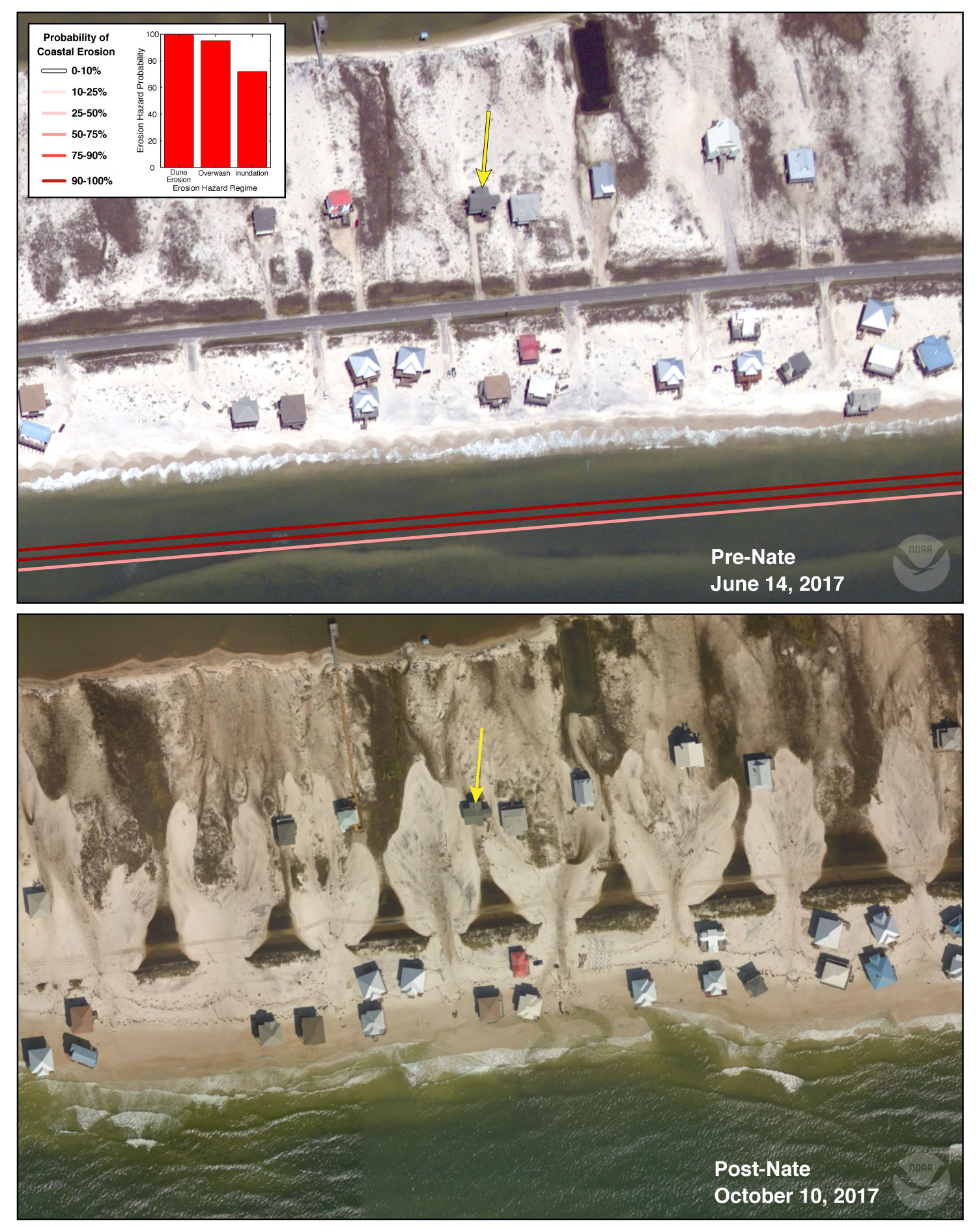
Pre-and Post Storm Photo for Hurricane Nate - Dauphin Island

Detailed Description
The low-elevation west end of Dauphin Island is especially vulnerable to storms and has been impacted by multiple storm events over the last decade. Storm surge and waves from Hurricane Nate overtopped and cut through the line of dunes in front of the road, depositing sand across the road in overwash fans. The predicted probability of overwash in this location was 95%.
Sources/Usage
Public Domain.