
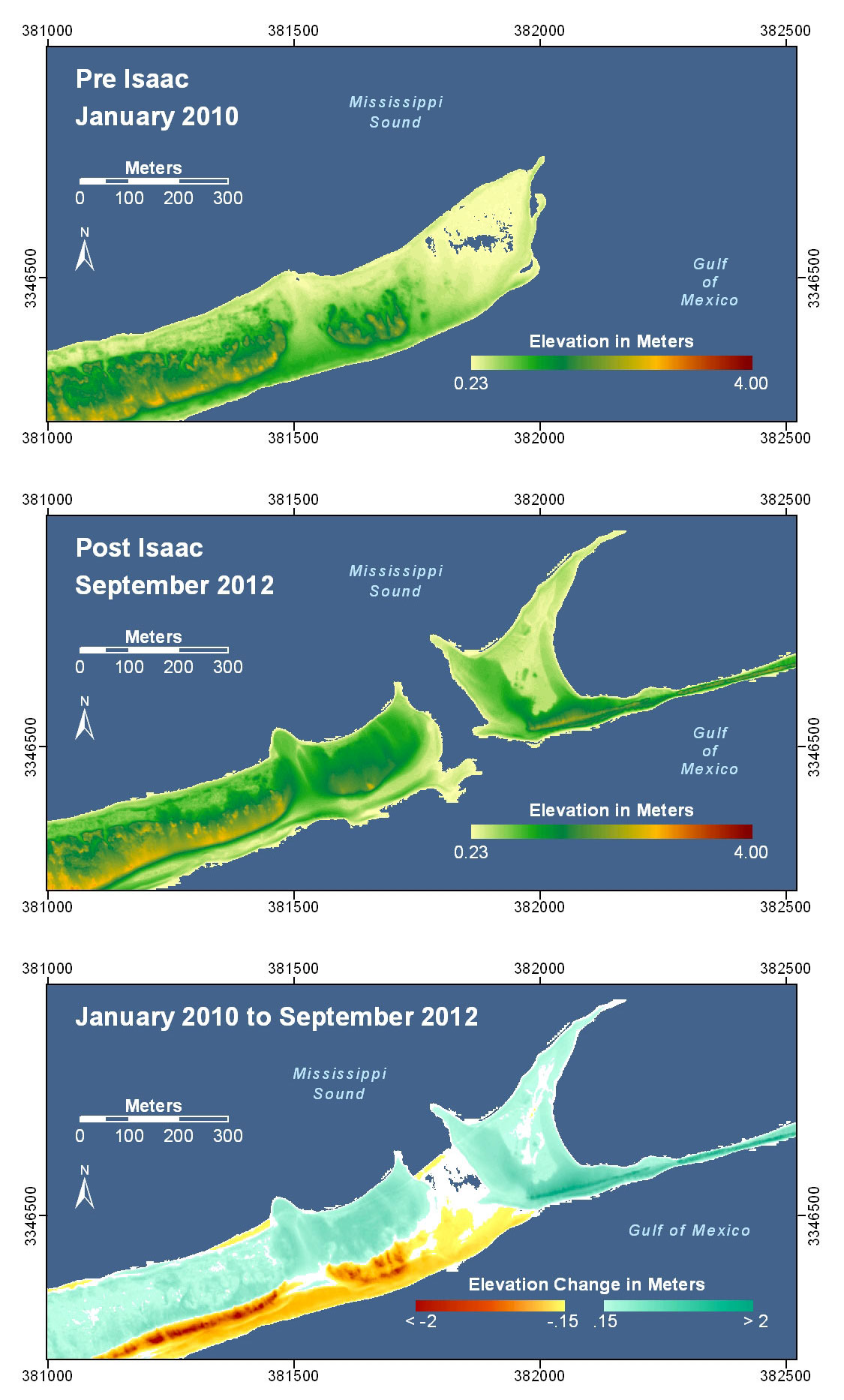
Pre-Storm and Post-Storm 3D Lidar Topography - Dauphin Island
By St. Petersburg Coastal and Marine Science Center
2012 (approx.)

Detailed Description
West of Katrina Cut, Dauphin Island, Alabama. The inlet that formed during Hurricane Katrina was closed with a rock structure (see photo pair locations 2 and 3) after collection of the pre-storm lidar and prior to Isaac's landfall and appears as a depositional feature. During Isaac, the island to the west end of the cut was breached and experienced shoreline erosion and overwash. The spit feature behind the rock structure formed prior to landfall.
Sources/Usage
Public Domain.
Public domain