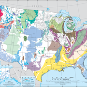
Principal Aquifers of the United States

Detailed Description
Two-dimensional map representation of the principal aquifers of the United States. This map, which was derived from Ground Water Atlas of the United States data (published as part of the National Atlas in 1998, revised 2003), indicates the areal extent of the uppermost principal aquifers on a national scale.
Sources/Usage
Public Domain.


