
Relocated Yellowstone seismicity recorded during 2008-2022
By Yellowstone Volcano Observatory
November 2025 (approx.)
Detailed Description
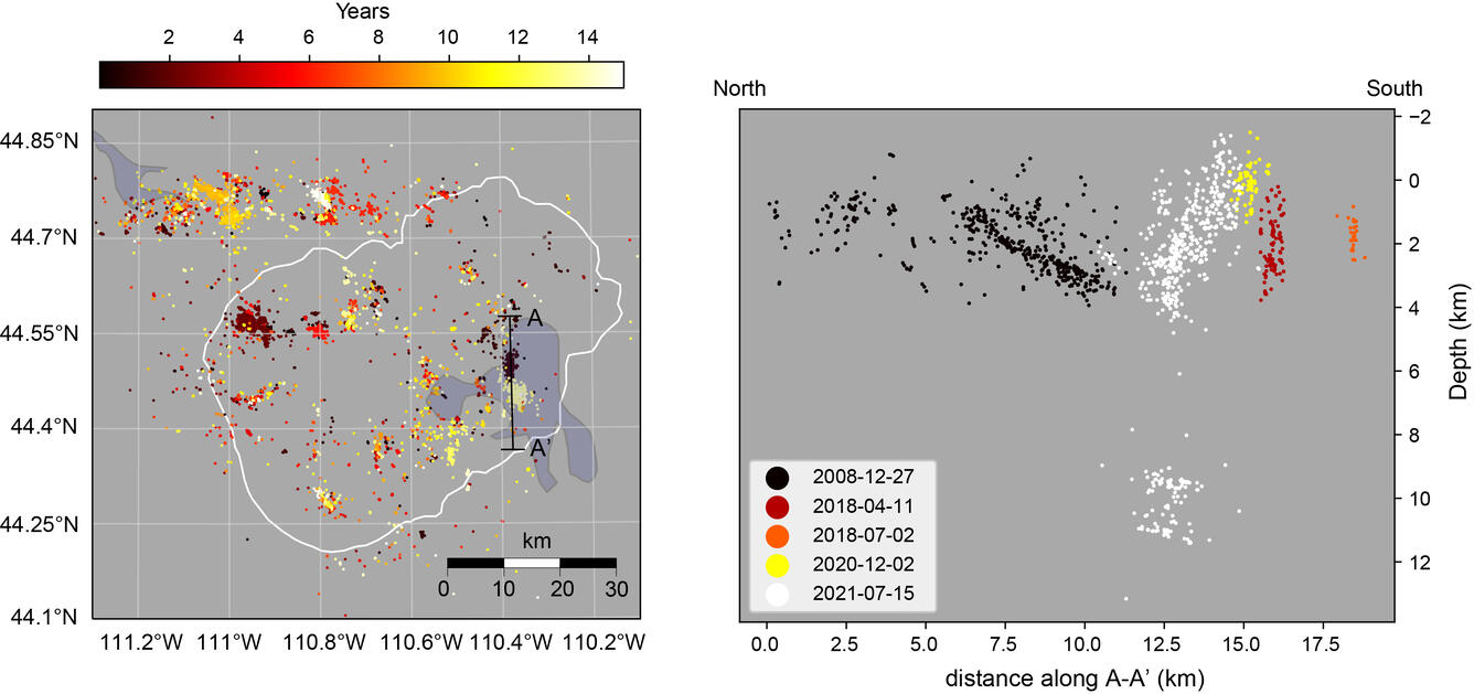
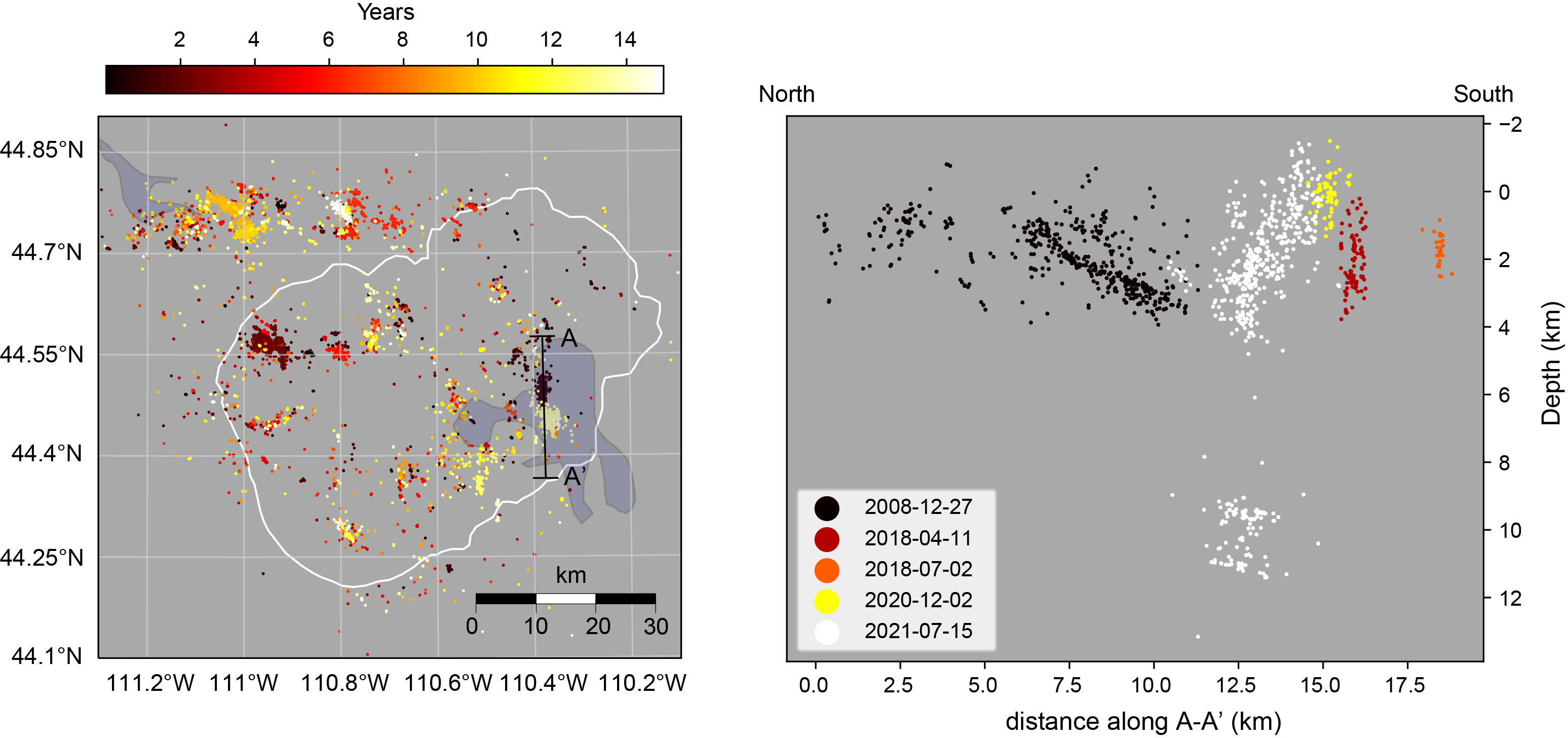
Map view of relocated Yellowstone seismicity recorded during 2008-2022, colored by time, on the left. White line gives the outline of Yellowstone caldera. The A-A’ cross section through Yellowstone Lake is shown at the right and illustrates how seismic swarms that are distinct in time relate to one another. Adapted from Florez and others, 2025 (https://doi.org/10.1126/sciadv.adv6484).
Sources/Usage
Public Domain.