
Rise of the Halema‘uma‘u Lava Lake—May 13, 2021

Detailed Description
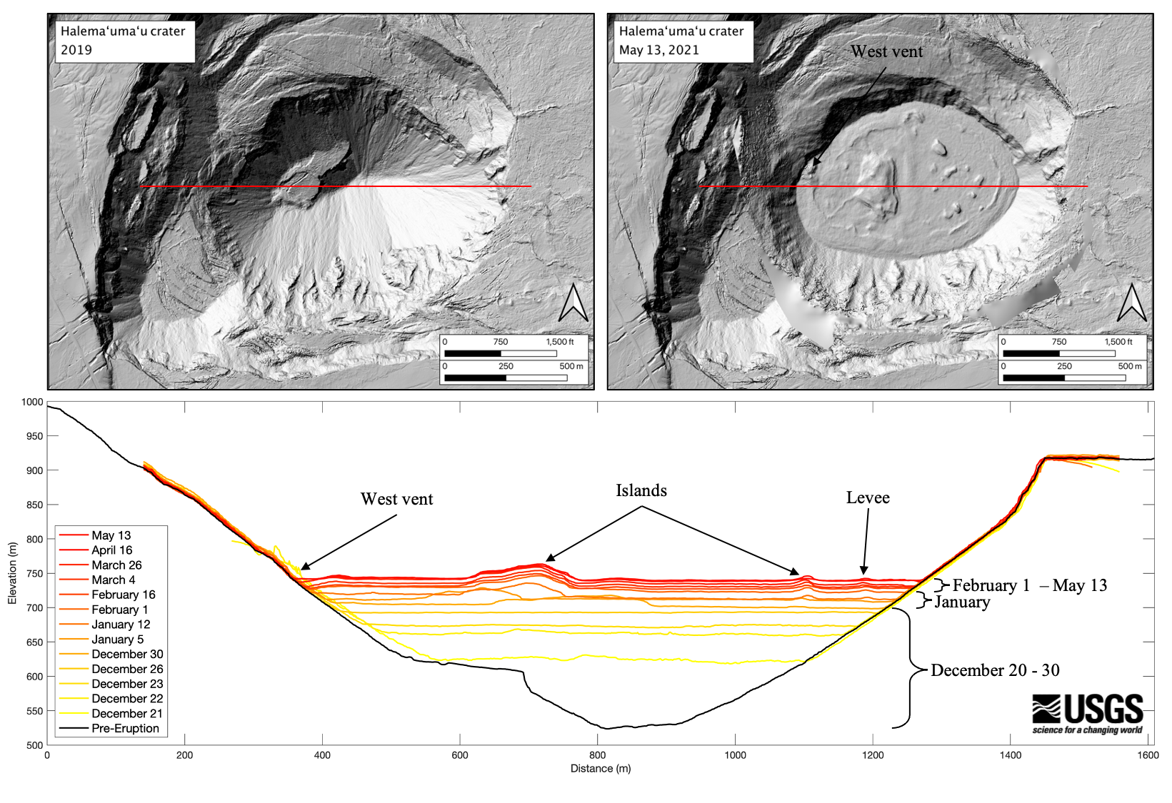
The digital elevation models (DEMs) created from photos taken during helicopter overflights of the Kīlauea summit have many useful purposes. Using an elevation profile line across Halema‘uma‘u crater from each DEM allowed HVO scientists to track the rise of the lava lake (bottom panel). In just the first 10 days of the eruption (Dec. 20–30, 2020), the lava lake rose to 80% of its current depth. The lake rose more in the month of January, about 25 m (82 ft), than it has in the last three months (about 15 m or 50 ft). The lava lake is now 229 m (751 ft) deep. The elevation profiles also show that the islands in the lake continued to rise with the lake surface. The top two panels show a pre-eruption DEM of Halema‘uma‘u crater from 2019 (left) and a DEM of the crater from May 13, 2021 (right). The red line in each top panel shows the elevation profile line used for the bottom panel. The profile line is one mile long. USGS graphic and data processing by B. Carr.
Sources/Usage
Public Domain.