
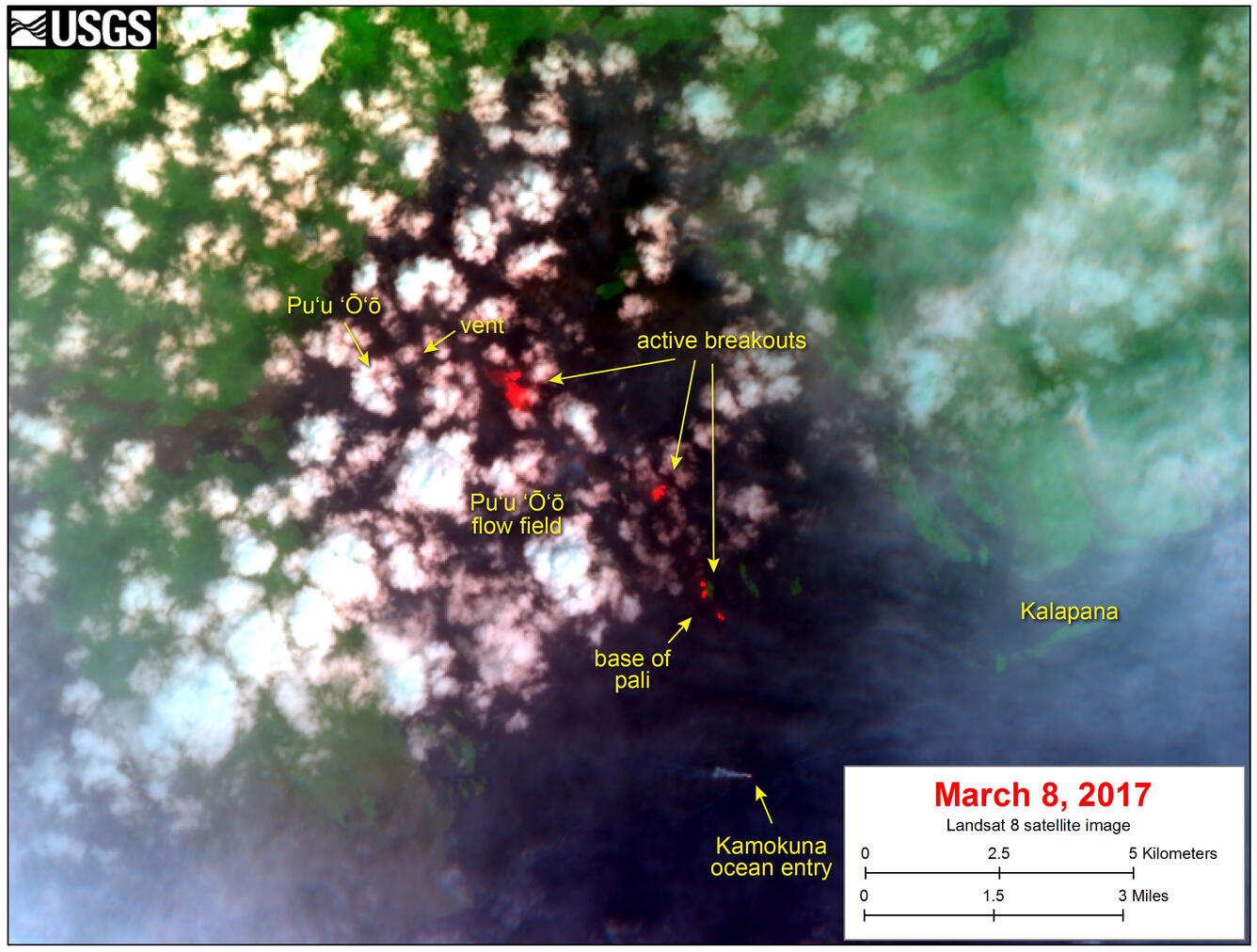
Satellite image shows continued breakouts on flow field
Detailed Description
This satellite image was captured on Wednesday, March 8, by the NASA/USGS Landsat 8 satellite. Although this is a false-color image, the color map has been chosen to mimic what the human eye would expect to see. Bright red pixels depict areas of very high temperatures and show active lava. White areas are clouds.
The image shows that breakouts continue in several areas on the flow field. The largest breakout is about 2 km (1.2 miles) southeast of the vent. Smaller breakouts are present above and on the pali. Near the base of the pali, on the coastal plain, a small breakout is active. A thermal anomaly is also present at the Kamokuna ocean entry.