
Satellite image shows June 27th lava flow
Detailed Description
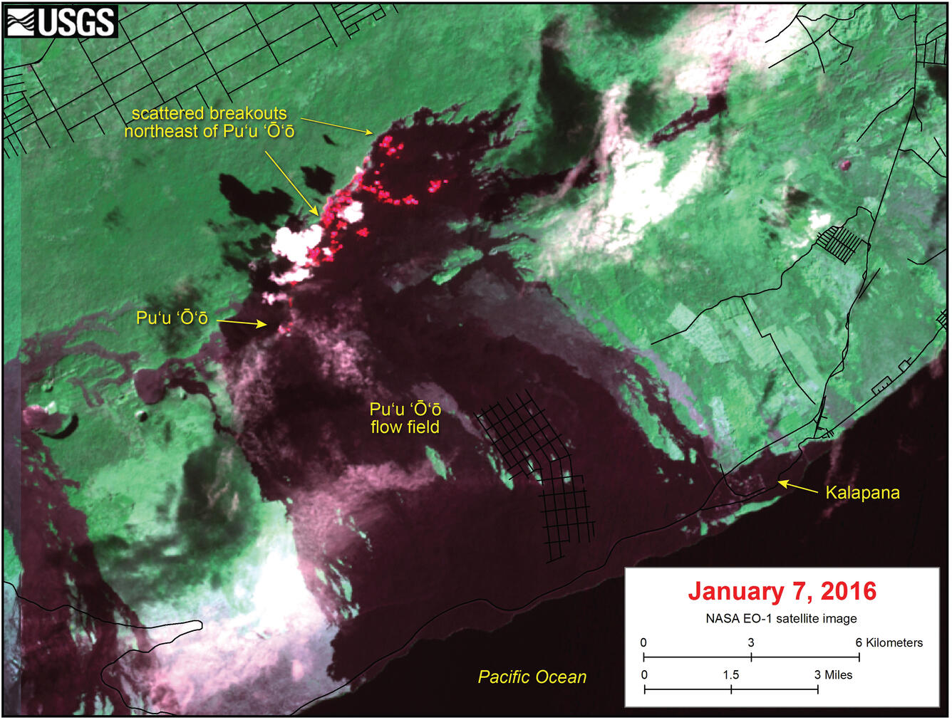
This satellite image was captured on Thursday, January 7, by the Advanced Land Imager instrument onboard NASA's Earth Observing 1 satellite. The image is provided courtesy of NASA's Jet Propulsion Laboratory. Although this is a false-color image, the color map has been chosen to mimic what the human eye would expect to see. Bright red pixels depict areas of very high temperatures and show active lava. White areas are clouds.
The image shows that scattered breakouts continue to be active northeast of Pu‘u ‘Ō‘ō, with no overall advancement in recent months. The farthest active lava was 5.6 km (3.5 miles) northeast of the vent on Pu‘u ‘Ō‘ō.