
Schematic illustration of inverted topography (NPS)

Detailed Description
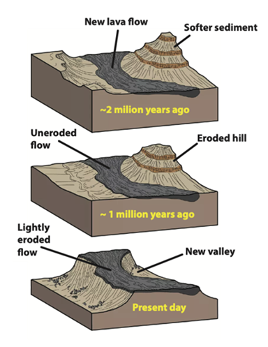
Schematic illustrations of the formation of inverted topography. Top graphic: Lava flows travel in topographic lows and valleys below surrounding topographic highs. Middle graphic: The hard volcanic rock protects the underlying country rock from erosion, eroding more slowly than the surrounding topography. Bottom graphic: stream valleys in which lava once flowed stand as high mesas above modern valleys. NPS image by Trista Thornberry-Ehrlich from https://www.nps.gov/articles/000/volcanic-inverted-topography.htm.
Sources/Usage
Public Domain.