



September 16, 2026—Kīlauea summit eruption reference map
Detailed Description
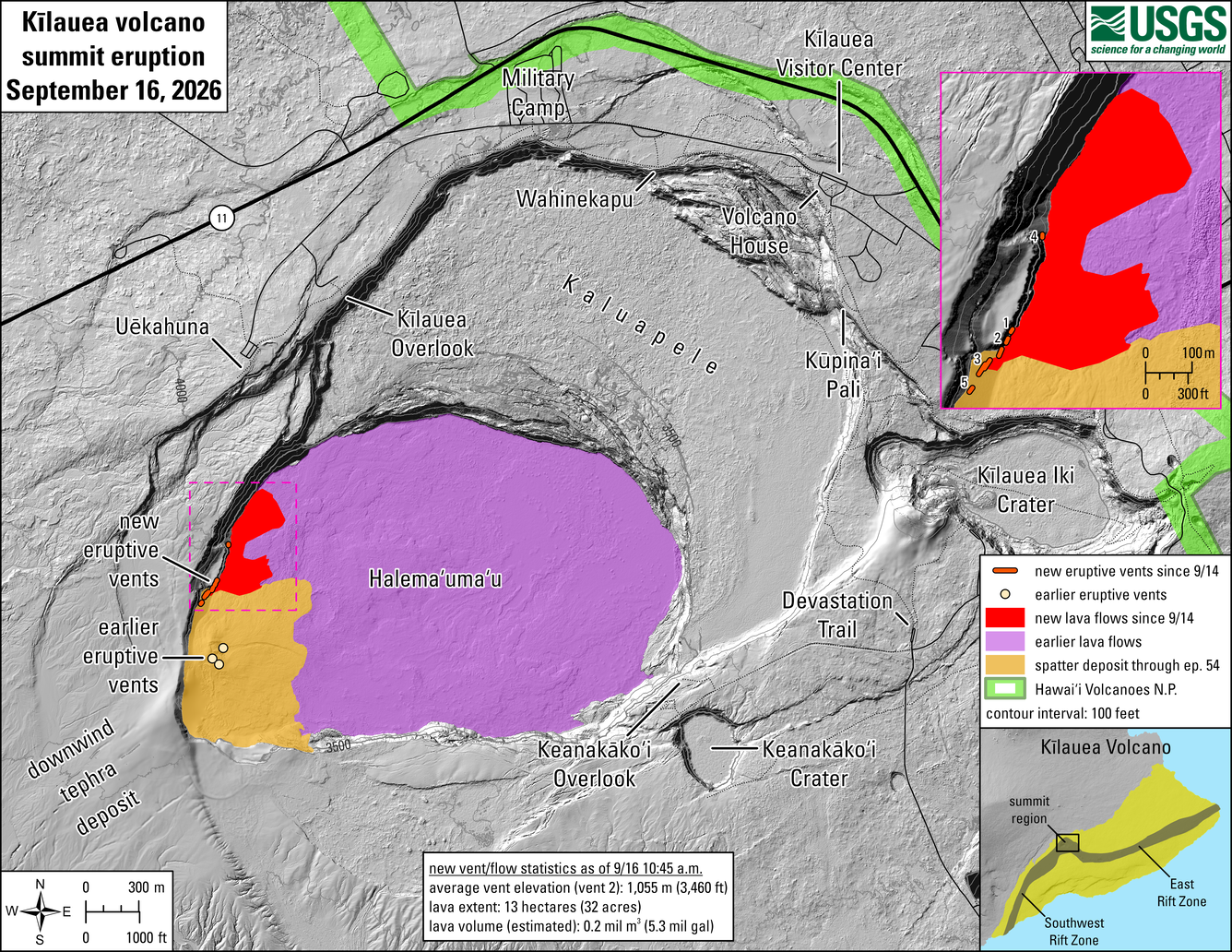
This reference map depicts new eruptive vents and lava flows in Halema‘uma‘u crater at the summit of Kīlauea since September 14, 2026. Most of the data for this map were collected during a USGS Hawaiian Volcano Observatory helicopter overflight on the morning of September 16. Five new vents have been active over the past two days, numbered 1–5 on the inset map to the upper right. The eruptive vents, spatter deposit, and lava flows associated with lava fountaining episodes 1 through 54, beginning December 23, 2024, are also shown.
New vent and lava flow statistics through September 16 at 10:45 a.m.:
- Average vent elevation: 1,055 meters (3,460 feet) above sea level
- Lava extent: 13 hectares (32 acres)
- Lava volume (estimated): 0.2 million cubic meters (5.3 million gallons)
Sources/Usage
Public Domain.