



September 23, 2026—New Kīlauea summit vents and lava flows, September 14–16

Detailed Description
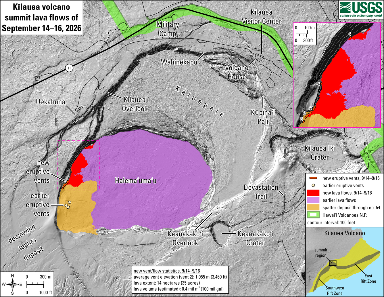
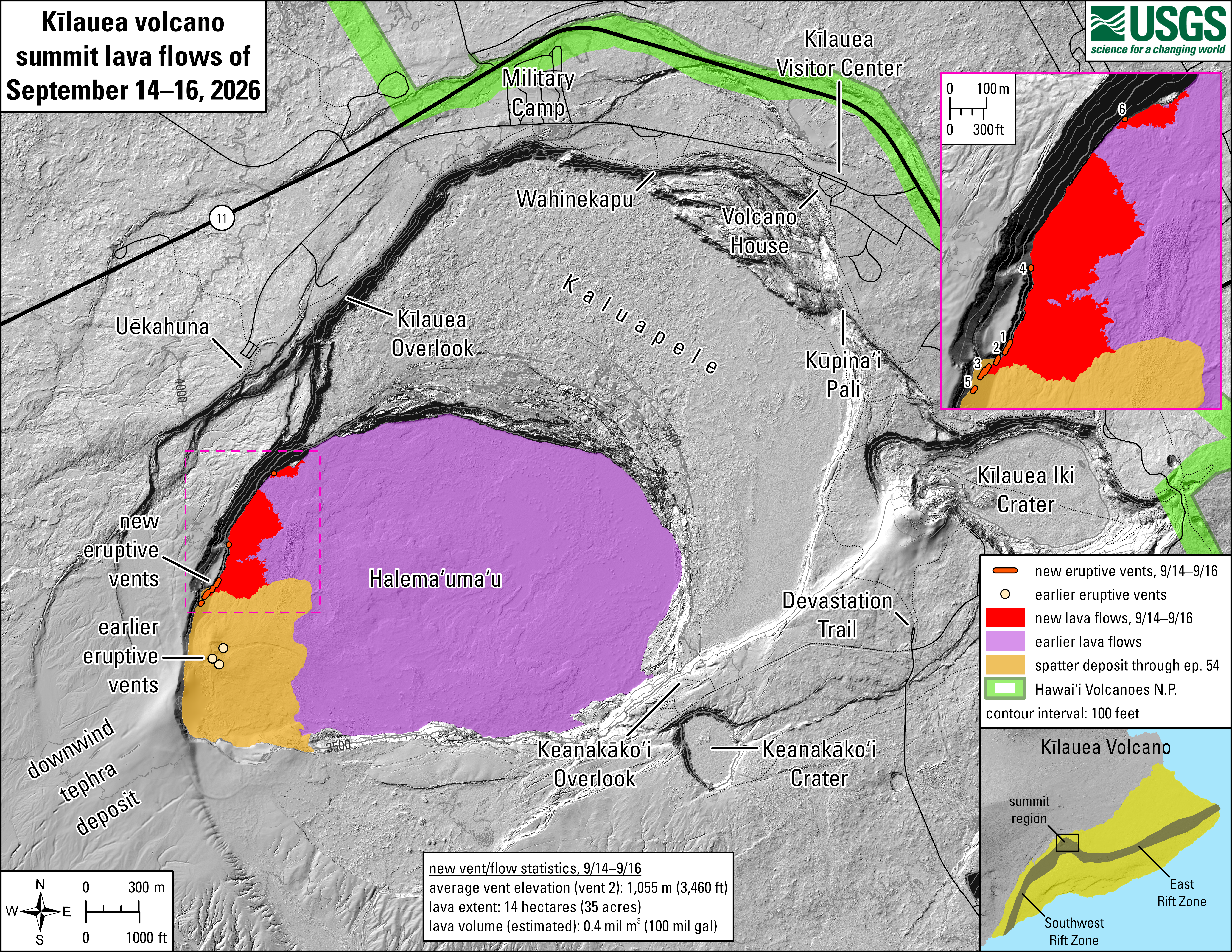
This reference map depicts new vents and lava flows that erupted within Halema‘uma‘u crater at the summit of Kīlauea from September 14–16, 2026. Most of the data for this map were collected during a USGS Hawaiian Volcano Observatory helicopter overflight on the morning of September 17, by which point eruptive activity had paused. Six new vents were active over the course of two days, numbered 1–6 on the inset map to the upper right. The eruptive vents, spatter deposit, and lava flows associated with lava fountaining episodes 1 through 54, beginning December 23, 2024, are also shown.
New vent and lava flow statistics through September 16 at 10:45 a.m.:
- Average vent elevation: 1,055 meters (3,460 feet) above sea level
- Lava extent: 14 hectares (35 acres)
- Lava volume (estimated): 0.4 million cubic meters (100 million gallons)
The previous version of this map published on September 16, 2026 indicated an estimated lava volume of 0.2 million cubic meters, but it was incorrectly converted to 5.3 million gallons; this value should have been 50 million gallons. The Hawaiian Volcano Observatory regrets the error.
Sources/Usage
Public Domain.
Related

Eruption Information
Related