
Shoreline Butte

Detailed Description
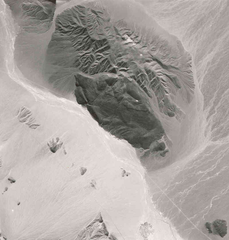
Shoreline Butte is located at the southern end of Death Valley and is at the northern end of the Confidence Hills (near the intersection of Highway 178 and the Harry Wade Road -- not shown on this image). The Amargosa River wash runs diagonally across the image, draining into Death Valley (on the left). The dry stream runs along the face of the butte where old shorelines of Lake Manly are preserved as steps on the north side of the remains of an ancient volcano. The southern side of the volcano has eroded away, exposing basin sediments uplifted along the Death Valley Fault system, the same fault system that has offset Split Cinder Cone (in the lower left-hand corner of the image) and is responsible for the uplift of the Confidence Hills. Scale (1:48,000); north is to the left.
Sources/Usage
Public Domain.