
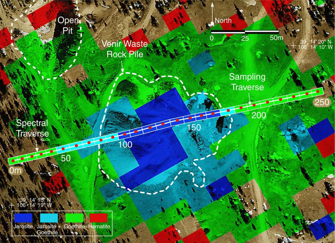
Spectral traverse and AVIRIS mineral maps
Detailed Description
Spectral traverse and AVIRIS mineral maps overlaid on a high-spatial-resolution aerial photograph of the Venir mine-waste pile. Mineral maps show the spectrally dominant Fe-bearing secondary minerals. AVIRIS pixels are shortened in the cross track direction (20 x 15 m) because of the high altitude of the Venir site. Nearest neighbor resampling was avoided during the registration process because it was important to preserve all details of the mineral zones at this fine spatial scale. Pixel orientation is that of the original AVIRIS flight line direction.
Sources/Usage
Public Domain.