
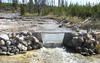
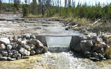
Tantalus Creek weir used for hydrologic monitoring, YNP.

Detailed Description
More than 97 percent of the outflow from Norris Geyser Basin exits via Tantalus Creek. The discharge from Tantalus Creek is monitored by a weir located about 100 meters from the confluence of Tantalus Creek with the Gibbon River. The discharge data is measured every 10 minutes. Plots are updated once a day.
Sources/Usage
Public Domain.