
Thermal map of fissure system and lava flows

Detailed Description
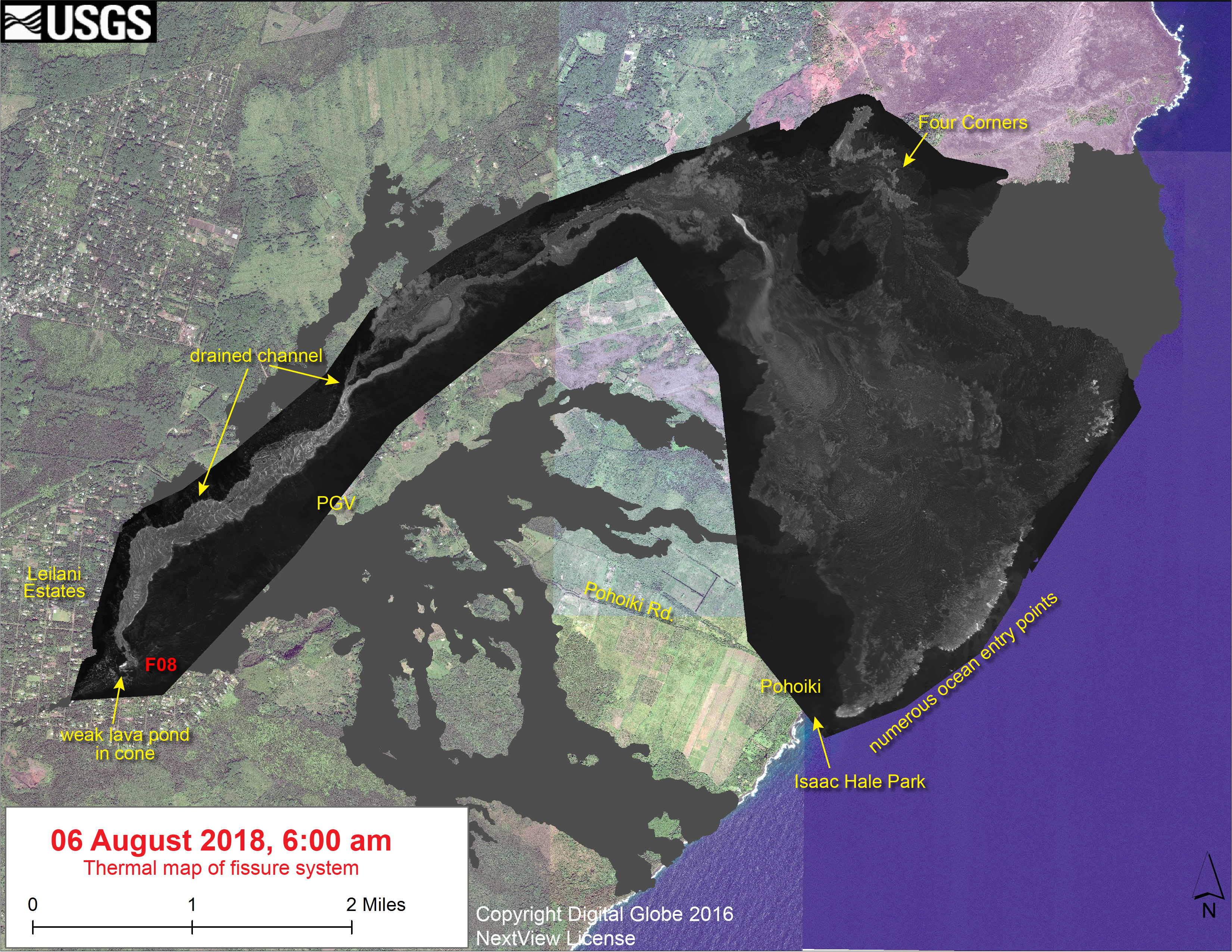
This thermal map shows the fissure system and lava flows as of 6 am on Monday, August 6. Fissure 8 activity has decreased substantially over the past few days, with only a weak lava pond active within the Fissure 8 cone. There were no signs on the surface of lava being supplied from the vent into the channel. Nevertheless, residual lava in the flow continues to enter the ocean, mainly around Ahalanui. The black and white area is the extent of the thermal map. Temperature in the thermal image is displayed as gray-scale values, with the brightest pixels indicating the hottest areas. The thermal map was constructed by stitching many overlapping oblique thermal images collected by a handheld thermal camera during a helicopter overflight of the flow field. The base is a copyrighted color satellite image (used with permission) provided by Digital Globe.
Sources/Usage
Public Domain.