
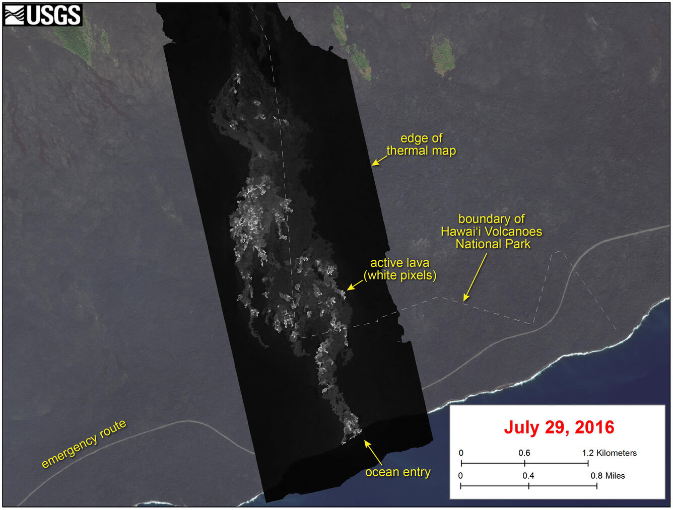
Thermal map of lava flow
Detailed Description
This image shows a thermal map of the flow on the pali and coastal plain, created from airborne thermal images. White pixels are hot, and show areas of active surface breakouts. The background image is a satellite image collected before the current lava flow was active.
The thermal map shows scattered pāhoehoe breakouts on the coastal plain, with a narrow lobe of lava crossing the gravel road and extending to the ocean. The ocean entry has widened since it first formed on Tuesday, July 26, and now spans about 240 m (260 yards) of the coastline.