
Tracking the growth of a new puʻu at Kīlauea
Detailed Description
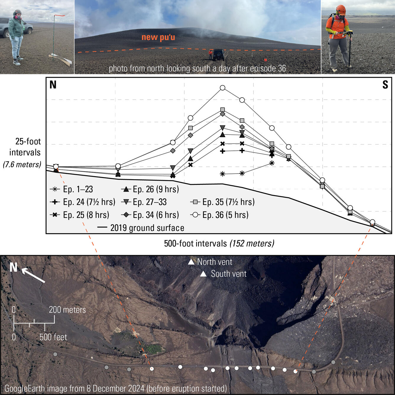
Top left photo: An HVO scientist stands next to a garden stake with 20-cm (8-in) intervals marked in blue, next to an old road sign that had been progressively buried by tephra during episodes 1-21; this photo was taken May 15. The next day, episode 22 completed buried the garden stake. Top middle photo: view of the new puʻu a few days after episode 36 on November 10. Top right photo: a visiting scientist from the Cascades Volcano Observatory takes a precise GPS location measurement from the top of the new puʻu; a parked vehicle at the base of the puʻu is visible in the middle right of the photo. Middle panel: profiles of the growing puʻu, showing how the puʻu has changed from episode 1 through the end of episode 36. Episode 37 is not shown because the puʻu had minimal growth. The top left photo is taken from underneath the highest point of the transect, and in the top middle photo, the orange bucket to the right of the vehicle is the location of the left-most measurement point of the transect shown in the middle panel. Bottom panel: Map showing where the GPS measurements are taken, with the image taken 16 days before the eruption started in December 2024. The white dots correspond to the profile shown in the middle panel.
Sources/Usage
Public Domain.