
Updated 2016 version of the East Austin US Topo quadrangle with orthoimage turned off to better see the improved road network. (1:24,000 scale)
Detailed Description
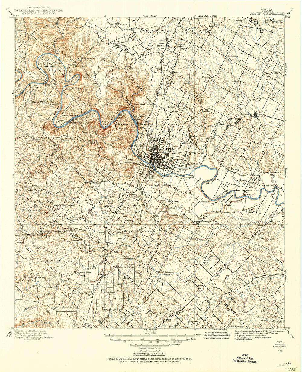
Scan of the1886 legacy topographic map quadrangle of the greater Austin, Texas area from the USGS Historic Topographic Map Collection
Sources/Usage
Public Domain.