
USGS 3D Elevation Program Fiscal Year 2026 Partnerships
Detailed Description
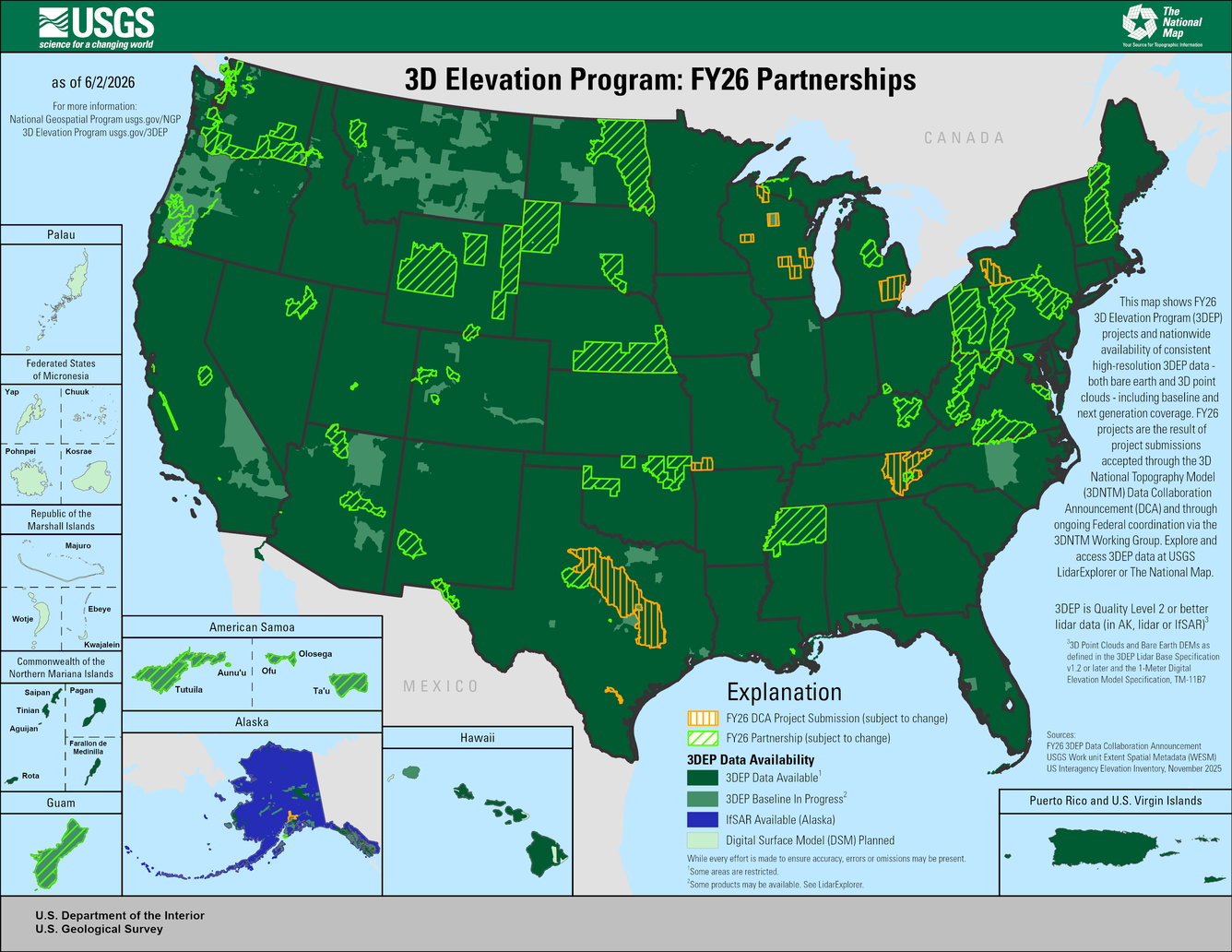
This map shows FY26 3D Elevation Program (3DEP) projects and nationwide availability of consistent high-resolution 3DEP data - both bare earth and 3D point clouds - including baseline and next generation coverage. FY26 projects are the result of project submissions accepted through the 3D National Topography Model (3DNTM) Data Collaboration Announcement (DCA) and through ongoing Federal coordination via the 3DNTM Working Group. Explore and access 3DEP data at USGS LidarExplorer or The National Map.
Explanation
- Yellow Stripe = FY26 DCA Project Submission (subject to change)
- Green Stripe = FY26 Partnership (subject to change)
- 3DEP Data Availability
- Dark Green = 3DEP Data Available1
- Medium Green = 3DEP Baseline In Progress2
- Dark Blue = IfSAR Available (Alaska)
- Light Green = Digital Surface Model (DSM) Planned
While every effort is made to ensure accuracy, errors or omissions may be present.
1Some areas may be restricted
2Some products may be available. See LidarExplorer
3DEP is Quality level 2 or better lidar data (in AK, lidar or IfSAR)3
33D Point Clouds and Bare Earth DEMs as defined in 3DEP Lidar Base Specification v1.2 or later and the 1-Meter Digital Elevation Model Specification, TM-11B7
Sources:
- FY26 3DEP Data Collaboration Announcement
- USGS Work unit Extent Spatial Metadata (WESM)
- US Interagency Elevation Inventory, November 2025
Visit the United States Interagency Elevation Inventory (USIEI) at
https://coast.noaa.gov/inventory/
Sources/Usage
Public Domain.