
USGS FIM Mapper screenshot.
2018 (approx.)

Detailed Description
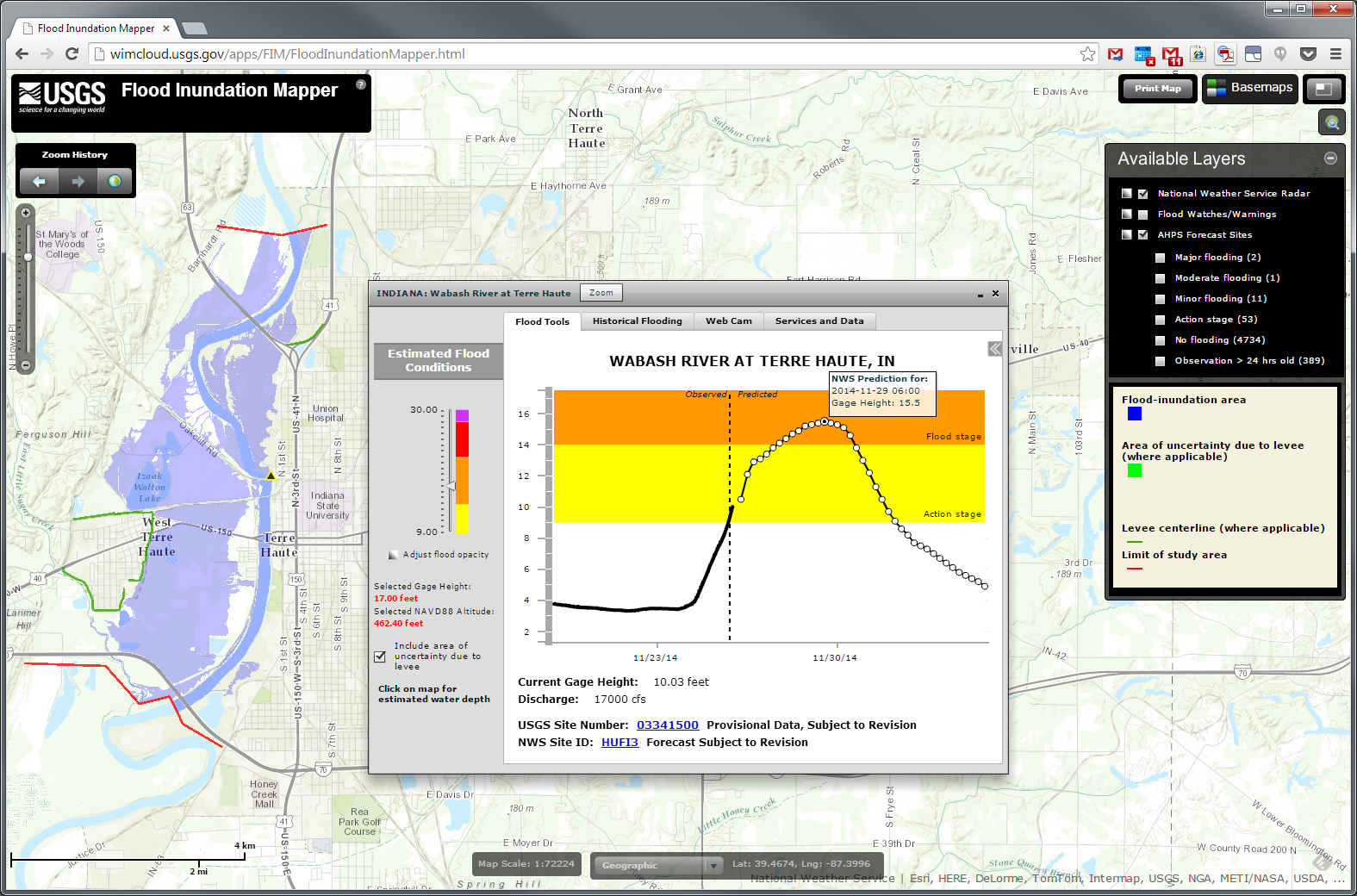
Figure 1. The USGS FIM Mapper, showing an example flood and hydrograph for Terra Haute, Ind. (Please note, the flood condition displayed represents a higher stream stage than shown in the hydrograph.)
Sources/Usage
Public Domain.