
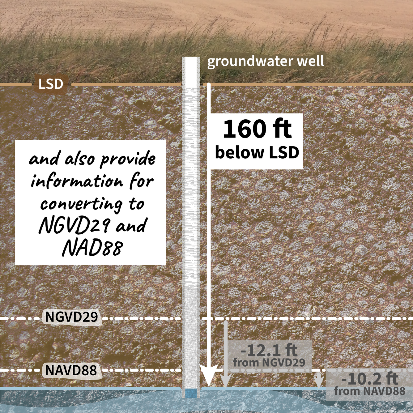
USGS monitoring location pages also provide information for converting from depth to land surface datum (LSD) to National Geodetic Vertical Datum of 1929 (NGVD29) or North American Vertical Datum of 1988 (NAVD88).
Detailed Description
USGS serves data from almost 1 million groundwater monitoring wells!
USGS Monitoring location pages show groundwater levels from LSD and provide information (and sometimes data) for other datums.
USGS monitoring location pages also provide information for converting from depth to land surface datum (LSD) to National Geodetic Vertical Datum of 1929 (NGVD29) or North American Vertical Datum of 1988 (NAVD88). In this case, the groundwater levels are lower, such that the depth from LSD is 160 feet, and the depth from NGVD29 and NAVD88 are -12.1 feet and -10.2 feet, respectively.
Checkout current or historic groundwater levels near you with the National Ground-Water Monitoring Network.
Relationships - Complicated #30DayChartChallenge
Sources/Usage
Public Domain.